Greenland
The South of Greenland is an Eldorado for adventurers, climbers, trekkers and nature enthusiasts, as well as landscape photographers. Here you will find incredible panoramas with fjords, ice and mountains, and with some luck you will also see northern lights. The fact that this area is still largely unknown to tourists, makes South Greenland a unique hotspot.
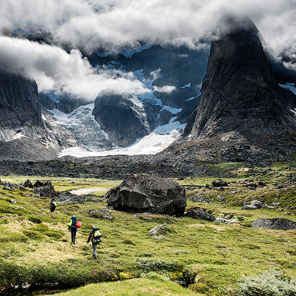
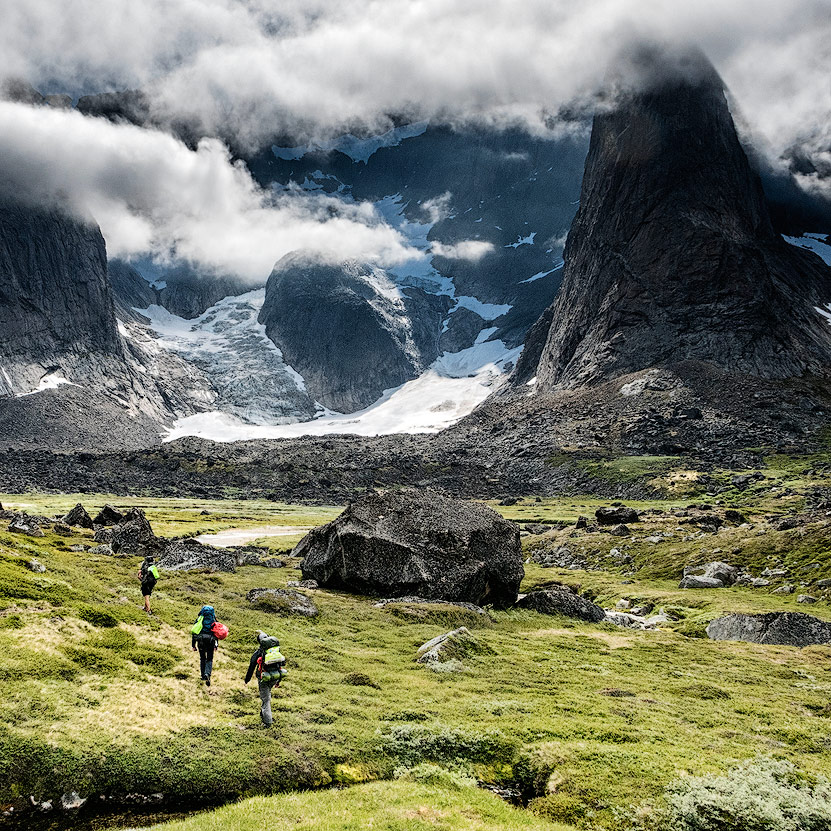
Trekking in the wilderness of Greenland
Tasermiut Fjord or the Patagonia of the North
Compared to Patagonia, Lofoten or Iceland, tourism in Greenland is still in its infancy. Although cruise ships are increasingly traveling towards Greenland, few tourists find their way to the southern fjords. This is likely to change in the coming years, however, due to the multitude of natural highlights.


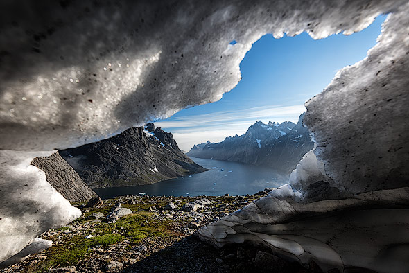
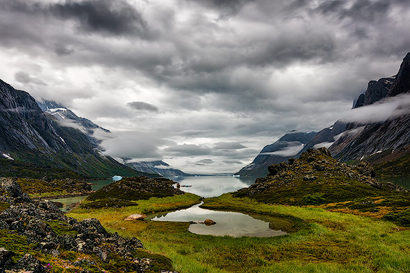
While I knew a lot about Illusiat (West Greenland) and Scorsbysund (East Greenland), I hardly had any knowledge of the South. I had only heard and read that it was very green and there were beautiful mountains. The fact that Greenland is called "Greenland" has to do with the immigrants exploring the largest island in the world, starting from the green south. Between the fjords plants and trees grow and sprout. Thick pack ice, that one would expect from Greenland, can only be seen as photogenic ice floes during summer, as it swims with the current and into the fjords. South Greenland offers perfect trekking conditions, unless you are plagued by mosquitoes or when you fight your way through tall bushes while struggling against the weather. A beautiful fjord, mountain, and glacier world can be found here, which will quench the desire for adventures in the most wonderful way.
Once I had seen the stunning photos of Max Rive, I realized that a Greenland trip would only be a matter of time. In August 2017 it was time and I joined Max on one of his Greenland tours. In my last travel reportage about Wildlife in Kenya. I mentioned that an individual trip would almost offer advantages compared to a group trip. In Greenland, however, it is different, because travel is only possible with boats and helicopters for the most part and thus it's also very expensive. In such remote and difficult to reach areas with limited travel time, a small group is absolutely recommended.
On foot or by boat
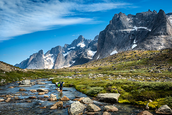
A trekking in Greenland should be well organized. We have seen only one boat from a distance on our trekking tour - the civilization and the nearest shop are far away. You could only go on foot or by boat.

In the tourism center in Nanortalik boat trips can be arranged or you can take a packraft with you to cross a fjord (which can be up to 70km long). If you are interested in a similar Packraft adventure, you should read Alex Nail's blog and Willem Van Doorne’s blog.
Max spent several months in this region to discover the most beautiful and attractive spots. Afterwards, he created an attractive and challenging trekking tour with a good mix of photography, hiking and adventure. If you prefer a boat trip to a trekking tour and prefer to stay in a rocking cabin than in the tent, you might also be interested in the tour of Daniel Kordan.
Nanortalik as starting point
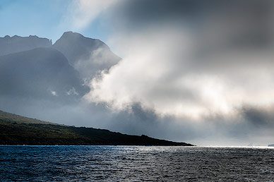
In Greenland you can adapt to the whims of nature and the weather. Similar to Iceland, there are fast weather changes and the conditions for a trekking tour can be extremely hard. A portion of luck regarding the weather is needed on arrival - flights from Copenhagen or Iceland are often canceled due to bad weather conditions. Therefore, it can be quite useful to schedule a reserve day for connecting flights. On the other hand, Air Greenland and DiskoLine are well prepared for spontaneous travel plans.
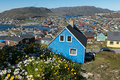
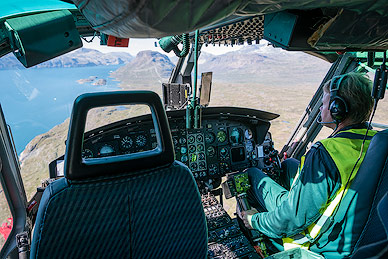
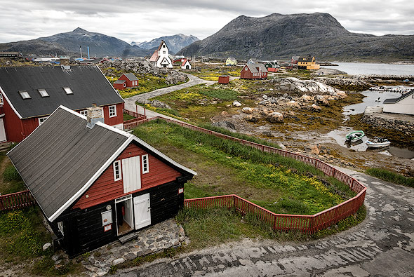
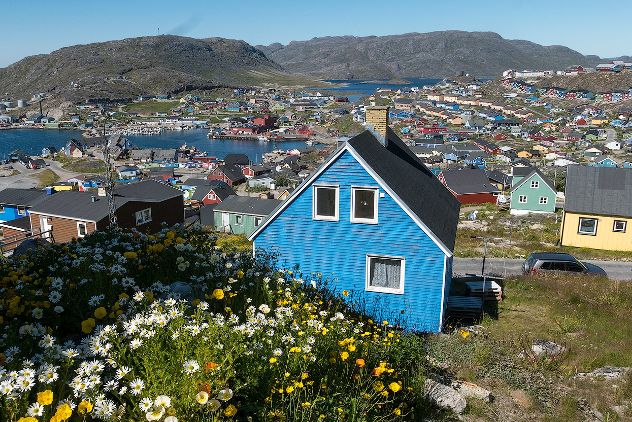
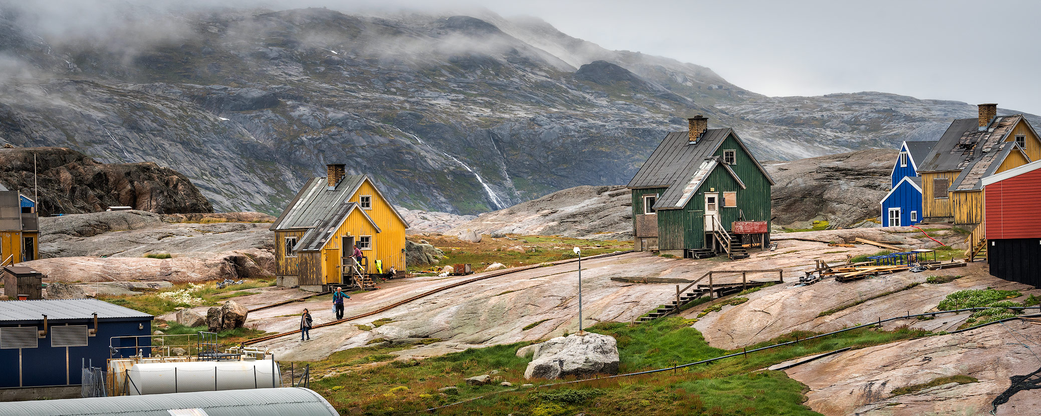
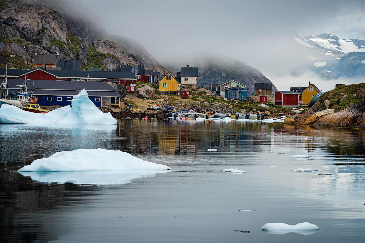
The small village of Nanortalik is a good starting point for all kinds of tours. The best way to get there is via Narsarsuaq (direct flights from / to Copenhagen) and from there by boat and / or helicopter (DiskoLine). My domestic travel cost about the same as the flight from Copenhagen to Narsarsuaq. A helicopter flight from Narsarsuaq to Qaqortoq is highly recommended, because the photogenic village is definitely worth a multi-hour stopover. Qaqortoq is one of the most beautiful villages in Greenland.
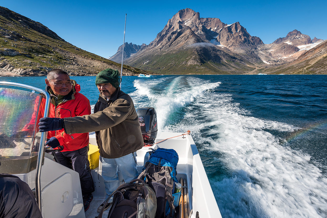
With a smaller boat we continued the journey from Qaqortoq along fjords and small islands towards Nanortalik.
The tourist center in Nanortalik is worth a visit in addition to the large shopping center with a good selection of wares (including bakery). If you do not have a hiking map, you will find it here. Recommended is the Hiking Map South Greenland Tasermiut fjorden - Nanortalik (1: 100.000). Niels, the head of the tourism center, is happy to provide information on tours and also usually knows whether polar bears have recently been spotted in the region.
Polar bears
Time and time again polar bears are driven towards the South on ice floes, where they get stranded after several days. Attacks on human beings are extremely rare - we are fortunately not on the menu of polar bears. However, caution is advised, so we were accompanied by Timo on our trek through the valley of Itillersuaq. Timo is a polar bear hunter from Aappilattoq: Safety first! On the last day of our tour, a polar bear was sighted in the surroundings of Tasiusaq. The travel plans of various adventurers were thrown into chaos because of that.

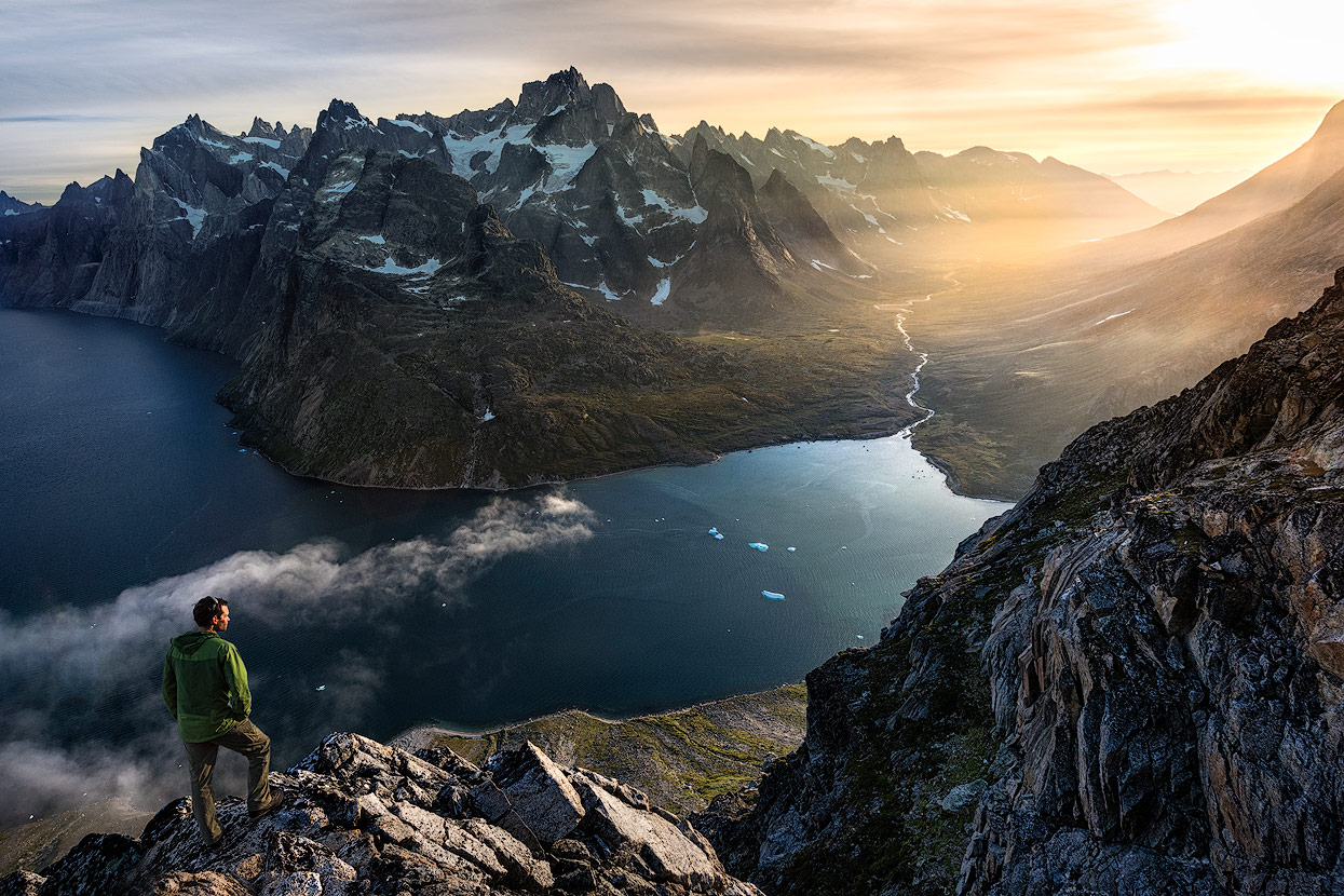
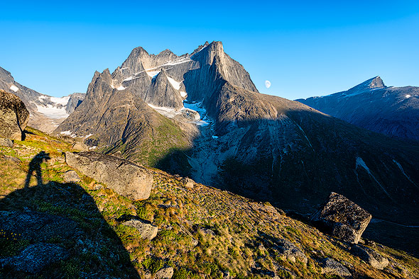
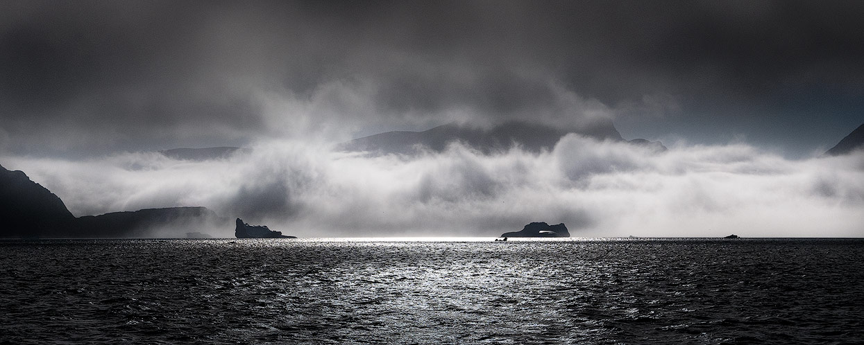
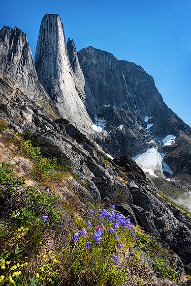
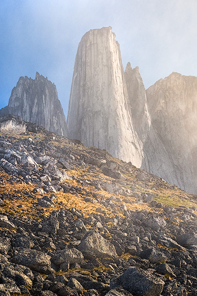
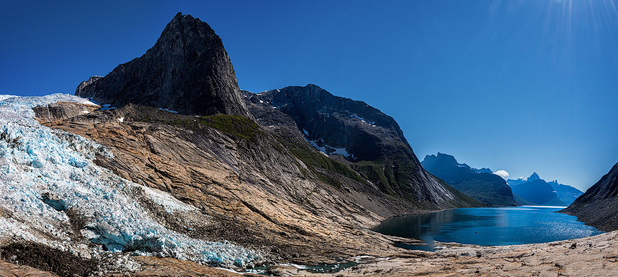
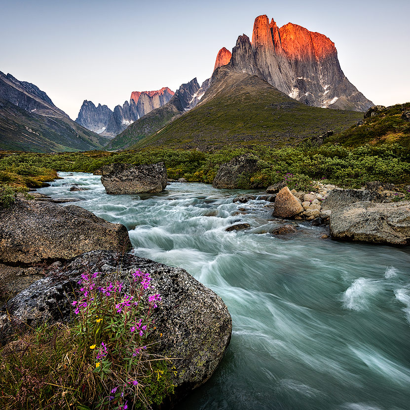
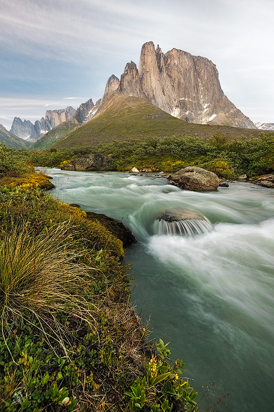
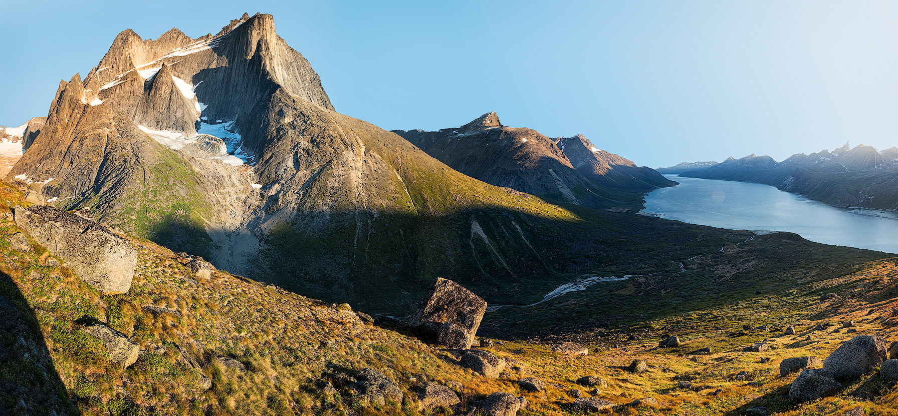
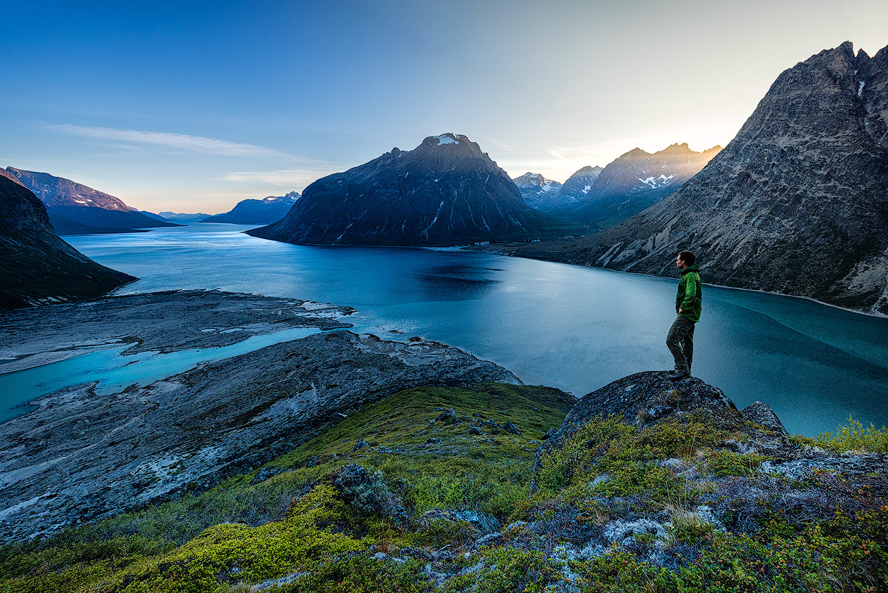
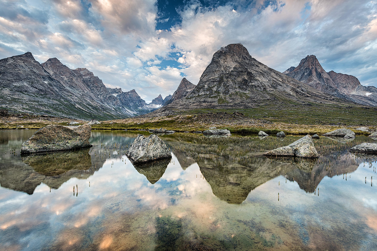
At Ulamertorsuaq in the Tasermiut Fjord
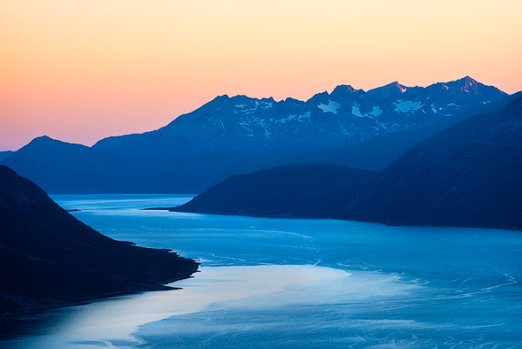
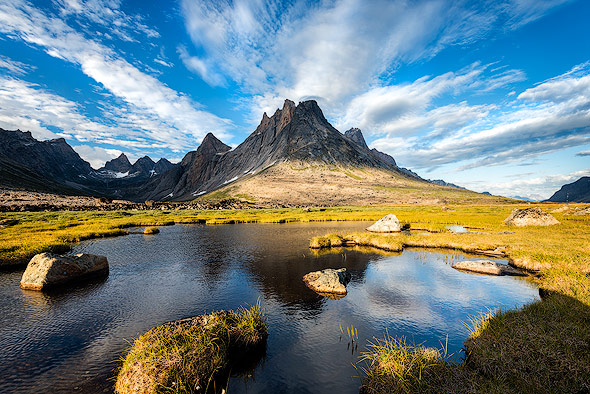
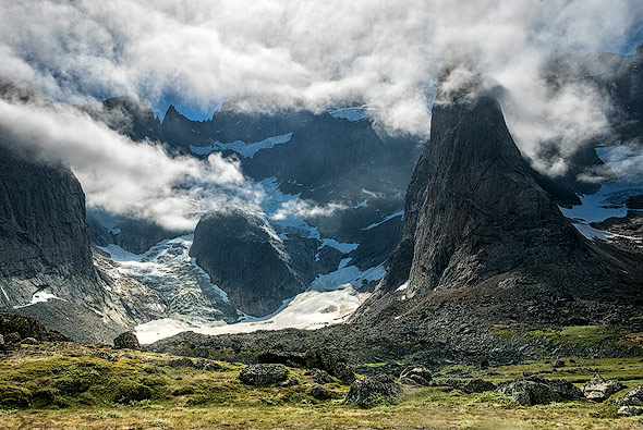
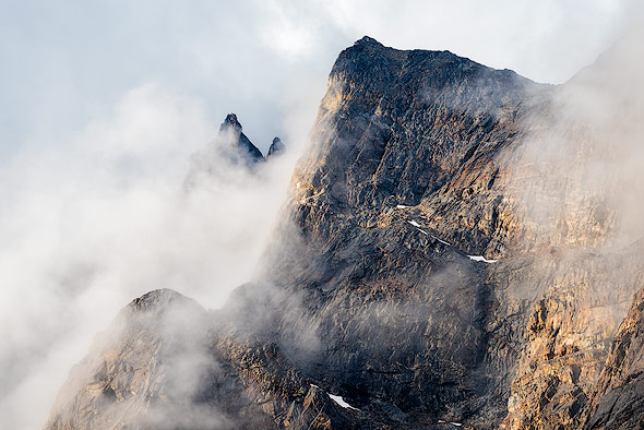
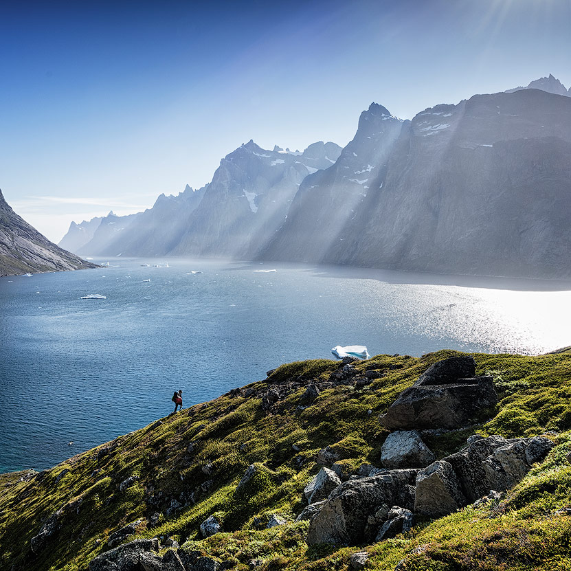
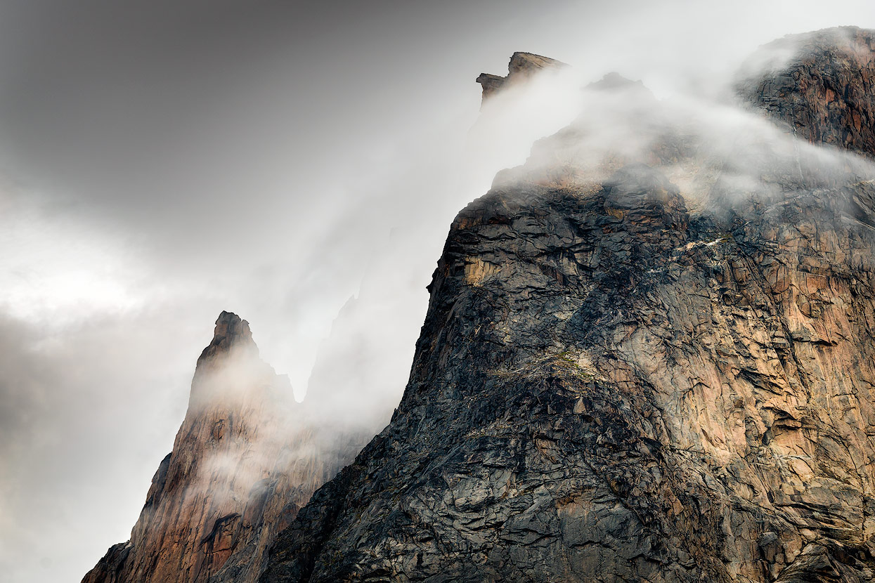
The 70 km long Tasermiut Fjord can be reached by boat from Nanortalik in about an hour. The further you drive into the fjord, the bigger and more photogenic the mountains will be. A highlight is the 1858m high Ulamertorsuaq (Greenlandic for "Big Cylinder"). Similar to its higher neighbor Ketil, the Ulamertorsuaq distinguishes itself through its granite walls which are up to 1000 m high. Especially the west wall has a reputation for being one of the most challenging big walls on the planet, comparable to El Capitan in the Yosemite NP or Cerro Torre in Patagonia. At the foot of Ulamertorsuaq, directly on the fjord and next to a river with the best Greenland drinking water, you will find a wonderful place to camp. Especially in the evening light, when the rock walls turn red, the camera should be within reach. We would have liked a few clouds here though...

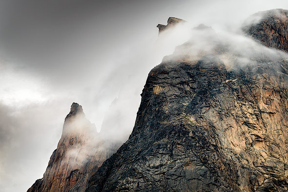
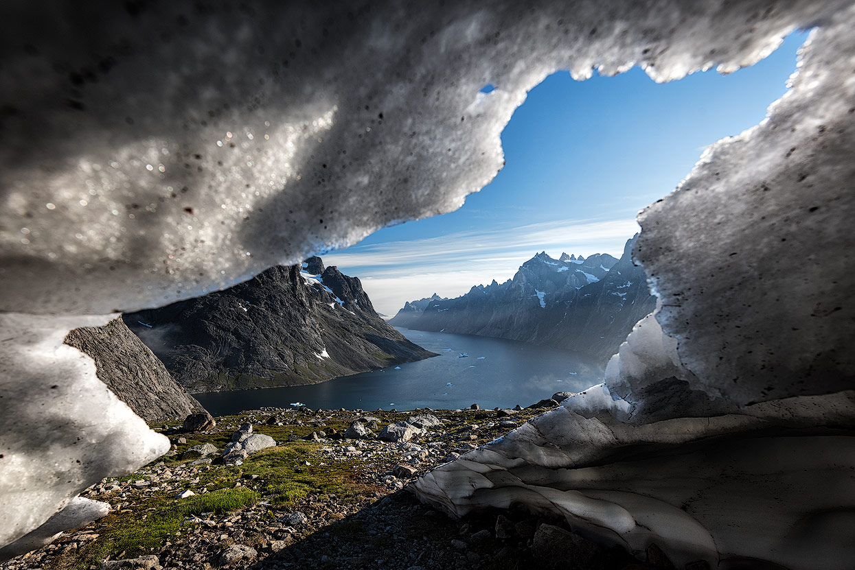
Unfortunately we kind of missed the sunrise the following morning due to the deep mist. Thanks to Max's drone, however, we were able to quickly find out how thick the mist was. So we climbed about 500 meter up the mountain and were rewarded with a beautiful misty sea, which soon began to dissolve.
If you walk around the rocks, you get a clear view of the impressive rock wall. Again, a few clouds would have been welcome!
To capture the evening mood, we climbed the hill on the west side in the evening, climbing about 400 meter this time. Finding a suitable foreground here was, however, much more difficult, and the perspectives of the rock walls are somewhat less spectacular.

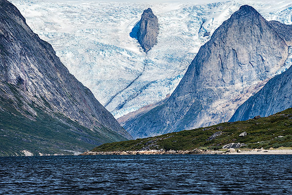
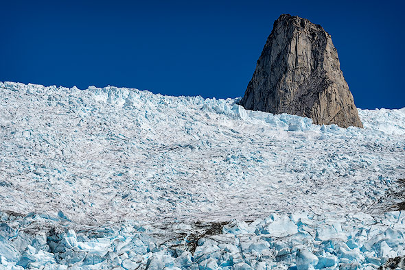
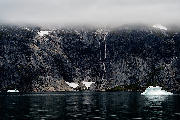
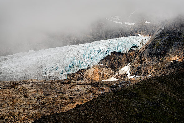
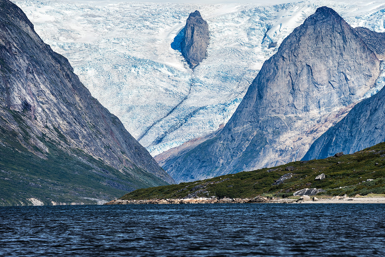
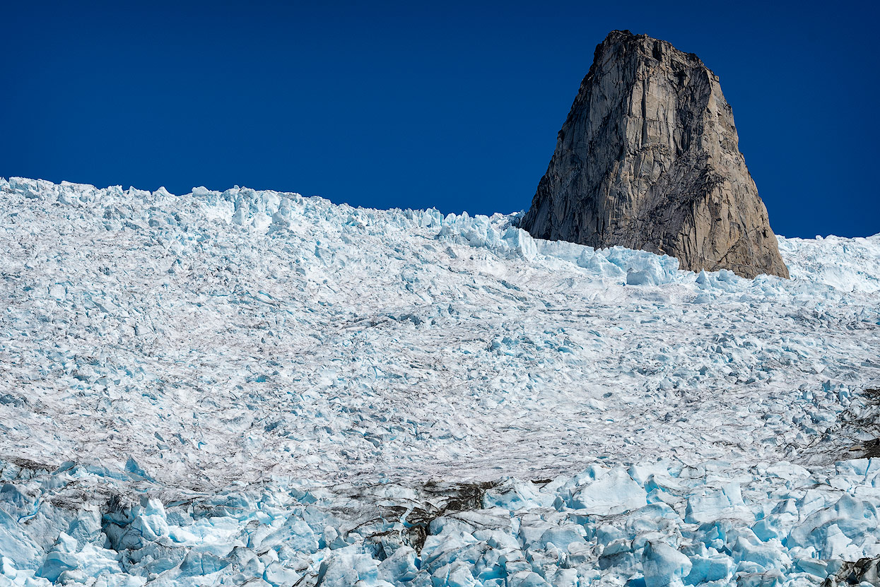
At the end of Tasermiut fjord
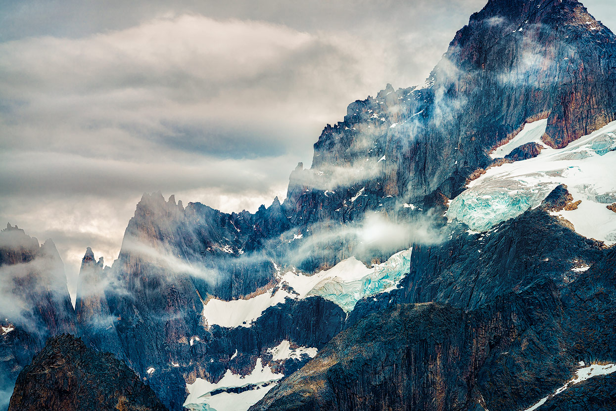
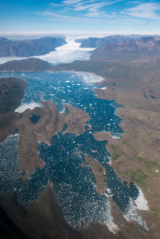
At the end of the fjord lies the Sermeq glacier, which reached all the way to the fjord a few decades ago. Today you have to walk for a while until you reach the ice. I do not want to imagine what the glacier will look like in 20 years! Particularly photogenic are the two rocks, which protrude from the glacier and look like horns.
The cloudless sky also caused a rather unspectacular sunset this evening. The hike to the viewpoint was made difficult by the high bushes and a lot of rubble, but the beautiful view of the fjord was still an experience and worth the troubles of the strenuous ascent!

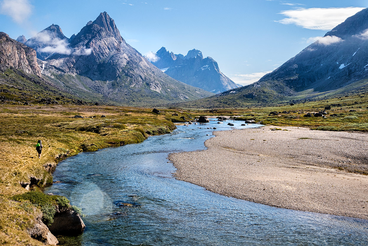
Trekking through the Itillersuaq Valley
On the following day, we were picked up by J.J. Simonsen and drove back to Tasiusaq, a small village on the Tasermiut fjord.

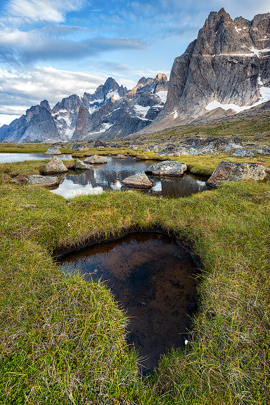
In front of us was a 20-kilometer-long hike on the «sheep trail» through the beautiful valley of Itillersuaq, along the river and accompanied by many mosquitoes. As soon as we had marched off with our packed backpacks, the fog gradually faded and a breathtaking mountain scenery was presented before us.
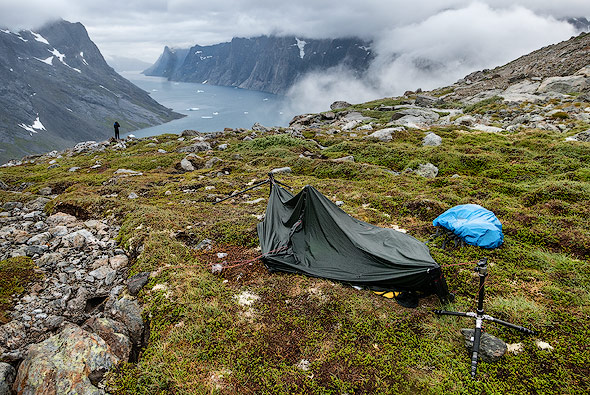
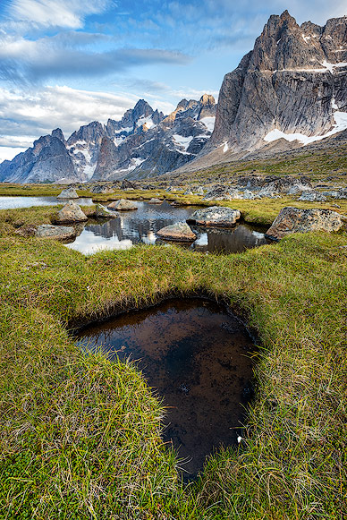
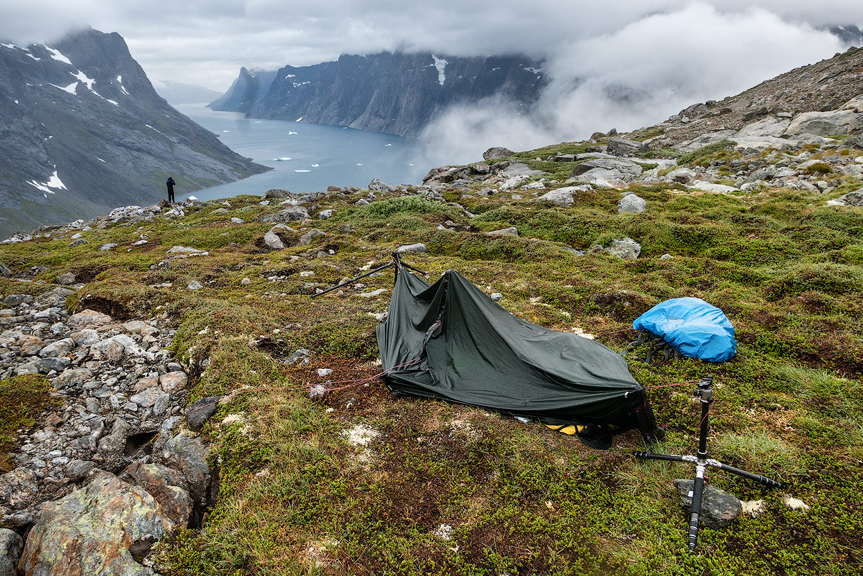
In the middle of the valley we set up our tents, surrounded by a marshy area with various small lakes. The wind passed through the valley and it cooled down strongly during the night. Early in the morning we were back in a thick layer of fog, but luckily it quickly dissolved again.


We had to cross several streams and smaller rivers to reach the next fjord. The 8-km-long hike - like the day before - was a unique scenic experience.

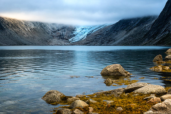
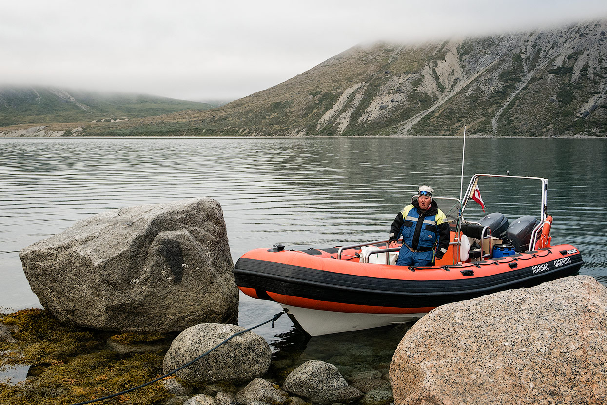
At the end of the valley, at the Stordalens Havn, much more ice floes were drifting across the river than in the Tasermiut. A captain from the nearby small village of Aappilattoq took us to the other side of the fjord. There we climbed 500 meters to reach a beautifully situated place, where we set up our tents.
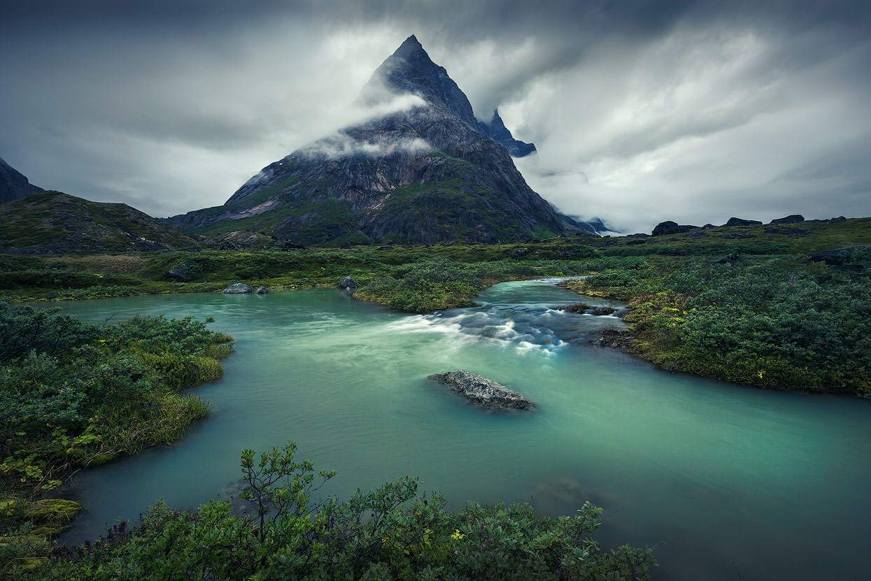
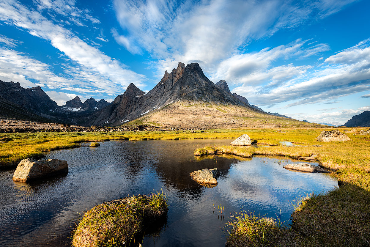
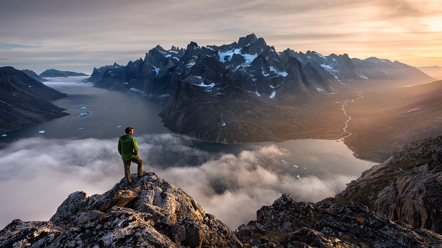
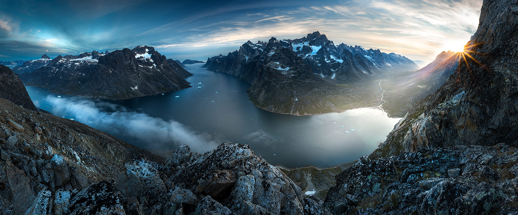
For the sunset, we wanted to go to the viewpoint, where Max made one of his favorite photo. Thus, despite tired and heavy legs, we climbed a further 200 heights over the rocks and rubble up the mountain and finally reached the vantage point at the best time. The mountains of the Alleruusakasit, towering steeply from the fjord, formed the perfect panorama and, together with the Ulamertorsuaq, were one of the greatest highlights of this tour.


After this wonderful day there was a change of weather and so we spent the next day almost exclusively in the tent. We made up for the lack of sleep and in spite of the rain we went to search for another good photospot or two.
Back to civilization
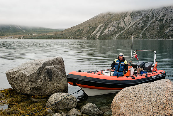
The following day was gray and wet as well, nevertheless we had to pack the tents and descend the 500m back to the fjord once again. There we were picked up by boat by Timo, our polar bear hunter. We drove to Aappilattoq and were able to stock up on all the important things in the small shop. The shop is only open for a few hours and only on a few days per week - a visit should be planned well!

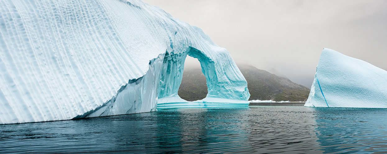
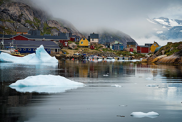
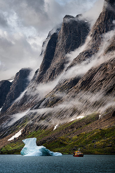
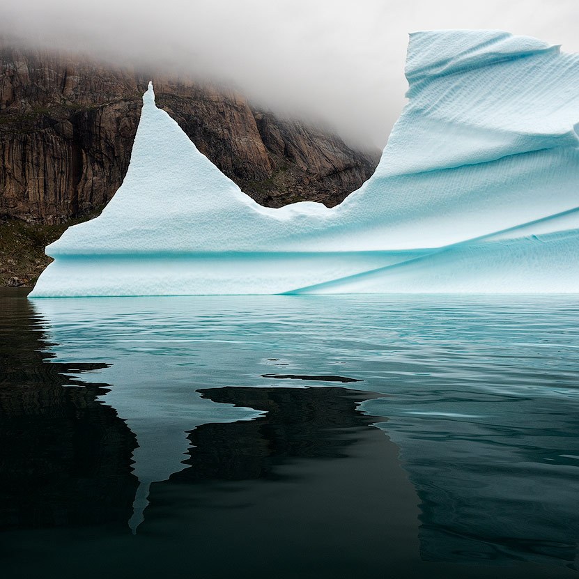
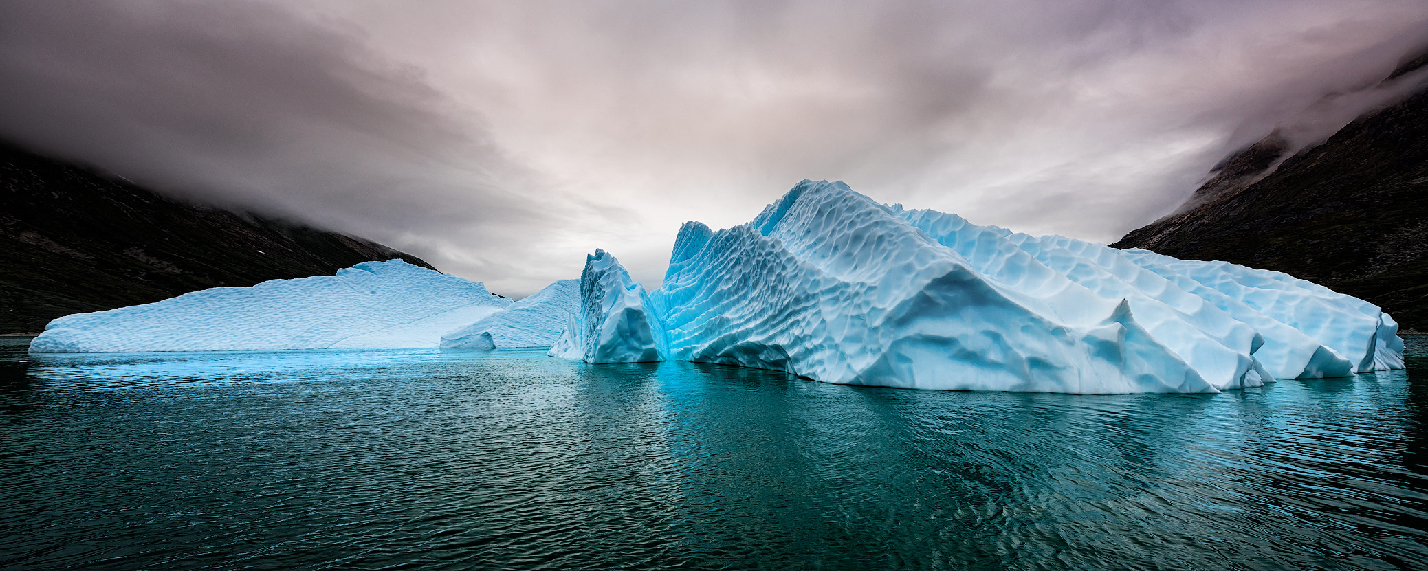
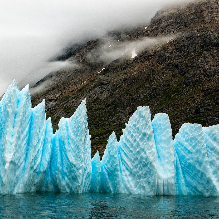
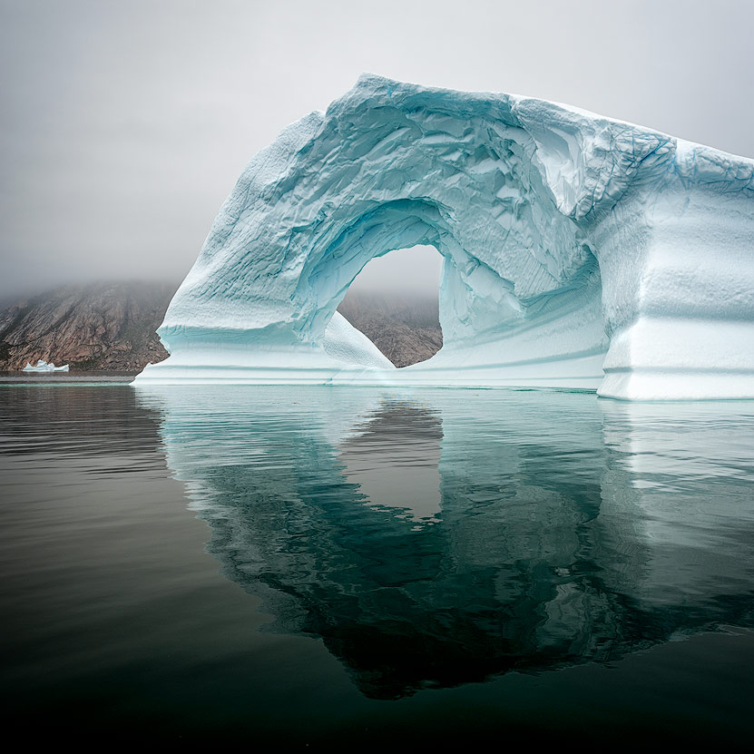
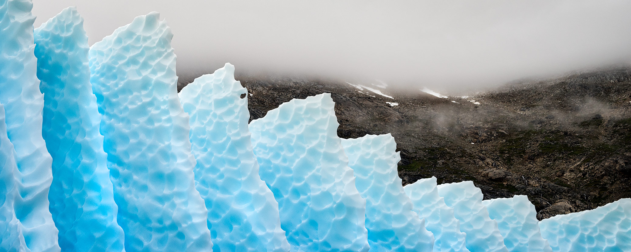
The icebergs in front of Aappilattoq
By boat we drove past numerous icebergs. While the big chunks come from pack ice, the pointed ice floes come from the glaciers. Each copy is unique and would have deserved its own photoshooting.


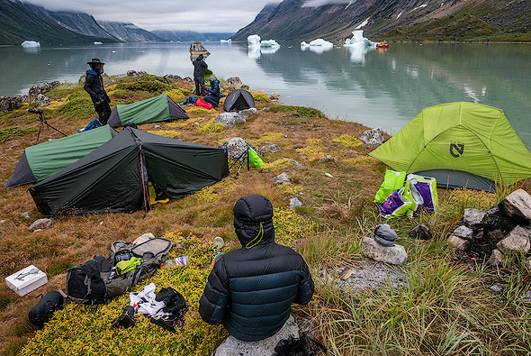
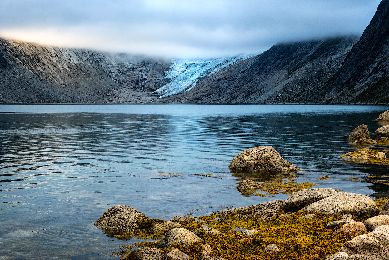
Our last campground at Kangikitsoq (Tupaussat valley)
At the end of the Kangikitsoq fjord, we set up our tents, right next to the water. The deep and fast-moving clouds provided a dramatic atmosphere - perfect weather for photographers so to speak! After much sunshine, cloudless skies and two rainy days, we also had the long awaited drama.
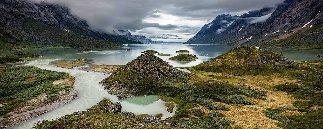
The cone shaped landforms are called molards: peace’s of permafrost cemented screeslope that came down as large blocks with the slide and then thawed into these cones. The landform is quite diagnostic for landslides. The slide must be quite old (100 to 1000s of years) as it looks like it is reworked by the glacier. Maybe it ran out on top of the glacier during the “little ice age”.
Back to Nanortalik
The following morning we drove back to Nanortalik by boat, which took about 3-4 hours. Fortunately, the open sea was mostly calm and so we arrived in Nanortalik with a healthy color on our face. The nicely located and furnished house is being rented out to Backpackers by the tourism center. We made ourselves comfortable and thought back to the fantastic tour once again.
What should you take with you?
When trekking every gram counts, so only the most important things should be packed. Unfortunately I ignored this advice!
- I took the D810 with the 14-24mm, 20mm and the new 70-200mm 2.8 with me. The Telezoom I have received for this trip was kindly provided by Nikon. I had a CircPol filter for all lenses (for the 14-24mm I used the filter of Wonderpana).
- As a tripod I used my light Gitzo GT2542 with the ball head BH-55 from Really Right Stuff. There should be enough batteries in the luggage and a remote release is also helpful.
- A few cleaning supplies for camera and lenses are also useful.
- The 70-200mm was rarely used - also due to weather conditions. The over 1 kg heavy lens is not really suitable for a trekking tour, but the quality of the photos speaks for itself. A lighter alternative would be the 28-300mm or the 70-200mm f4. The 20mm is known for its beautiful stars. I used the 20mm only once and would not take it with me again for obvious reasons.
- Fortunately you can drink fresh water from the rivers in Greenland (but please not from glaciers). You won't get better and fresher water anywhere! Katadyn filters or other drinking water tablets are not needed in Greenland and fortunately no large bottles of water have to be carried around - which could of course allow you to bring another lens ...
- With a stable tent (typically 4-season tents) you are also equipped for stormy weather. If it comes to clothes one should - as is standard for a trekking tour - put the onion layer principle to good use.

FUTURE MEMORIES BY MAX RIVE
The hightlights of this year’s Greenland tours have been captured in Max’s video.