ATACAMA DESERT & ALTIPLANO
A Journey through the Highlands of Chile and Bolivia. Landscapes of superlatives: from the driest desert in the world (Atacama) through the world’s largest salt flat (Salar de Uyuni) to the driest city in the world (Arica) – the North of Chile and the South-West of Bolivia are unique in many respects.
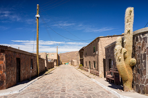
Atacama Desert
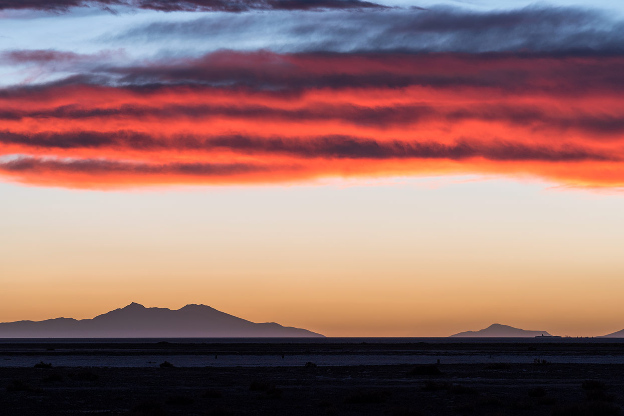
There is no desert on Earth drier than the Atacama Desert in northern Chile – decades can pass by without a drop of rain. The desert around San Pedro de Atacama is one of the country’s most popular travel destinations and the small village has completely dedicated itself to tourism.
Most booked tours in San Pedro de Atacama
The centre is awash with hotels, restaurants and tour guides, mostly offering the same tours:
- Valles de la Luna y de la Muerte / Moon Valley and Death Valley (in the late afternoon with sunset)
- Geysers del Tatio / Tatio Geysers (before sunrise)
- Piedras Rojas, lagunas altiplánicas y salar / Red Stones, high plateau lakes and salt flats (full day)
- Astronomical tours (after sunset)
The sights in the Chilean part are ideal for full-day tours, making San Pedro de Atacama a very suitable base. It also lets you acclimatise to the altitude, especially before travelling on to Bolivia.
Group or Solo Tour?
We didn’t want to book a group tour, so we rented a car in San Pedro. The small, not so easy to find and sporadically manned Europcar branch didn’t seem all that professional, unfortunately. The car had a couple of problems right away, like a broken fuel display, which prompted us to buy a full replacement can from the only petrol station in San Pedro. If you don’t speak Spanish and want to be on the safe side, it’s probably better to rent a car in Calama, the next larger city with better infrastructure and even an airport, or join a group tour.
If you’ve read my previous travel reviews, you know my opinion on guided group tours: these groups usually give you as much freedom and flexibility as a zoo animal. The strict itinerary is the top priority, so these tours often come with more stress than enjoyment for nature fans and photographers.
Salt Flats and Lakes in the Atacama Desert
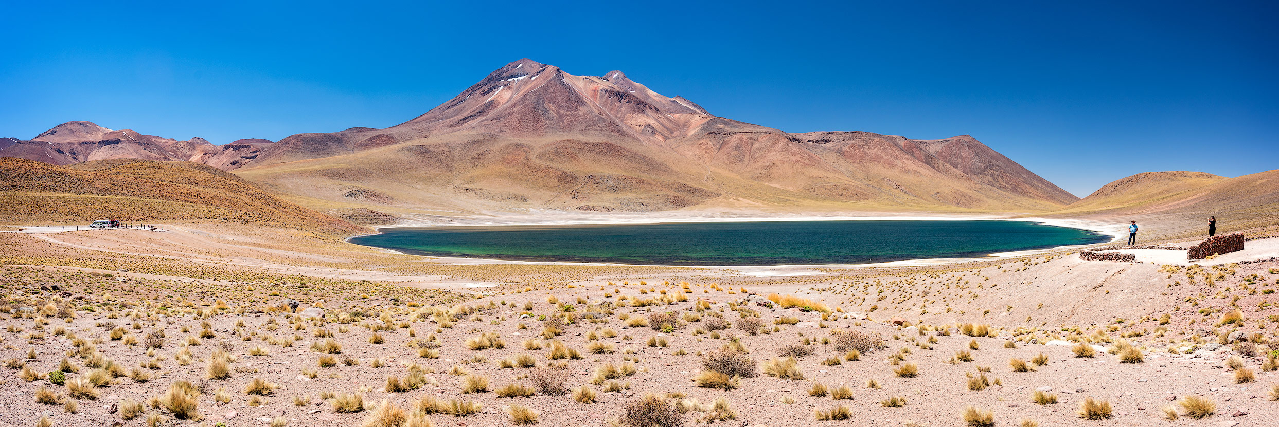
Lake Miscanti & Lake Miñiques
On the first day after our arrival in San Pedro, we headed to the Miscanti and Miñiques lakes. The road to the lakes got a little steep and hilly towards the end but it was fine in a normal car. The lakes and their infrastructure are managed by the local villagers, who explain their strict rules to all the tourists at the gate (in Spanish).

My attempt to leave the stone-marked path for a better view was met with loud whistles from the guide. So I had to do without a panoramic photo with both lakes in one photo (inspired by countless images on 500px and GettyImages). How did those other photographers make it to their unofficial viewpoint?
But it seemed as though these strict rules were sadly necessary due to the large number of visitors. The lakes aren’t really worth the entrance fee, so those travelling on to Bolivia can skip this without worry.
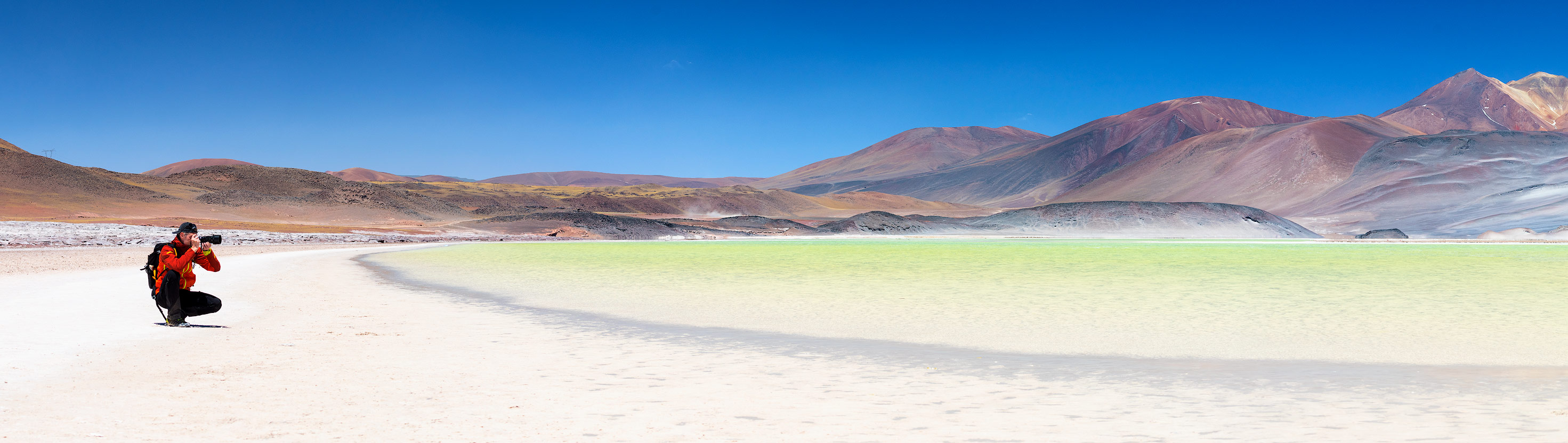
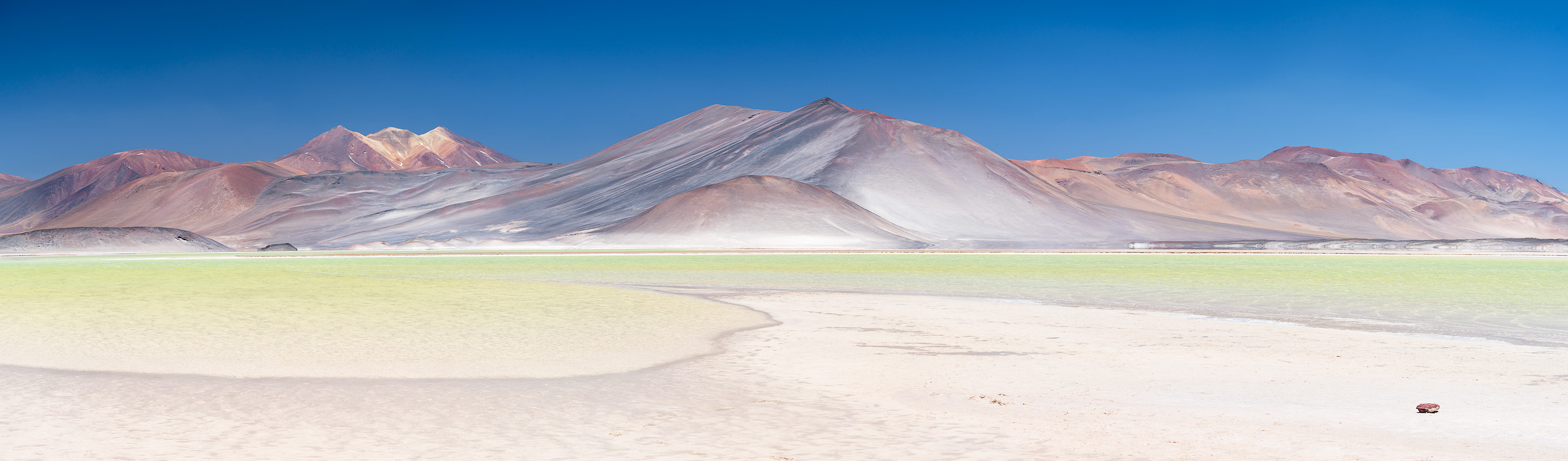
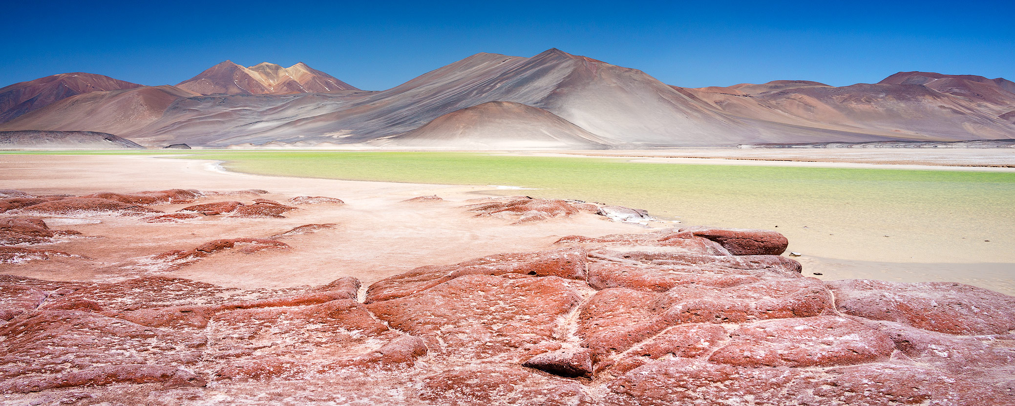
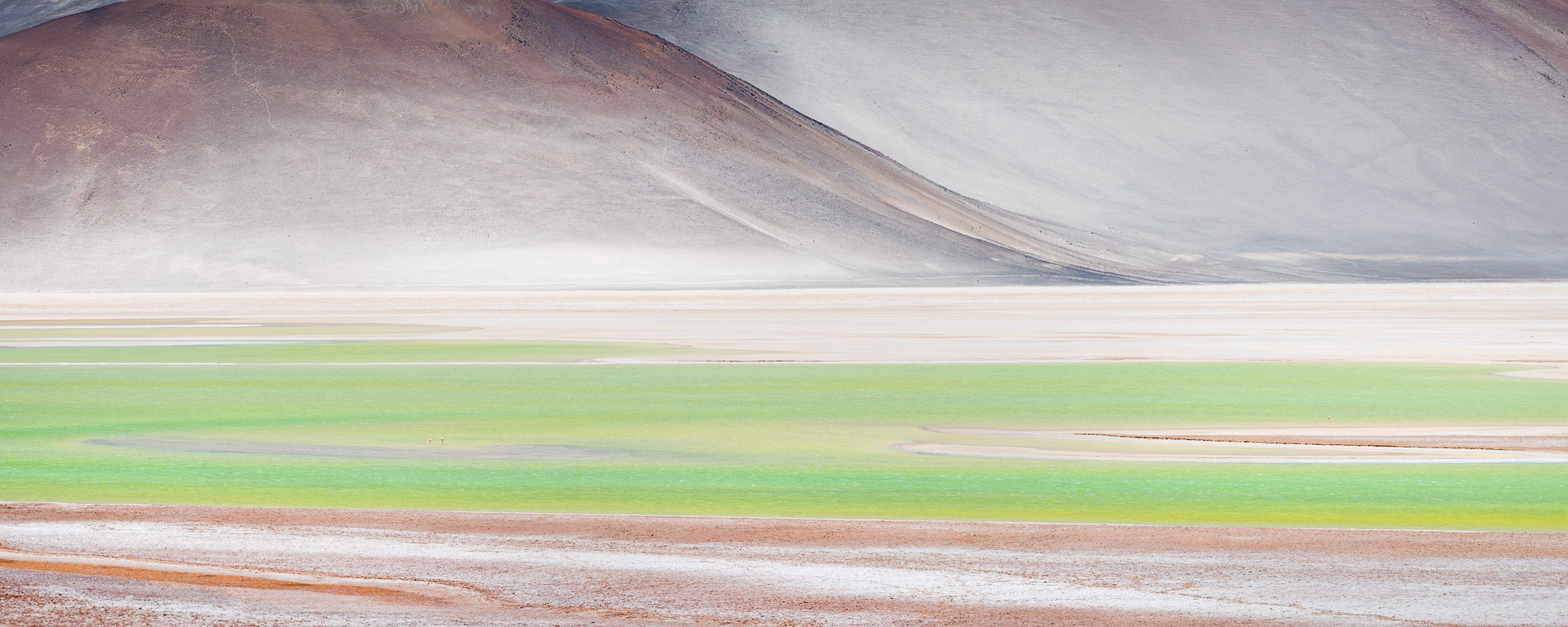
Piedras Rojas at the Salar de Talar
We then travelled on to the wonderful and impressive Piedras Rojas (Red Stones) at the Salar de Talar. There are considerably fewer tourists here but entrance is free and you can move around much more freely. A mini paradise for photographers and landscape lovers! Why the Miscanti and Miñiques lakes are more popular and more famous than the Salar de Talar is a mystery to me. The road there was being resurfaced during our visit, so the salt flat will likely be visited by more and more tourist coaches.
Make sure you have circ pol filters and lenses with focal lengths between 14 and 200mm in your camera bag.


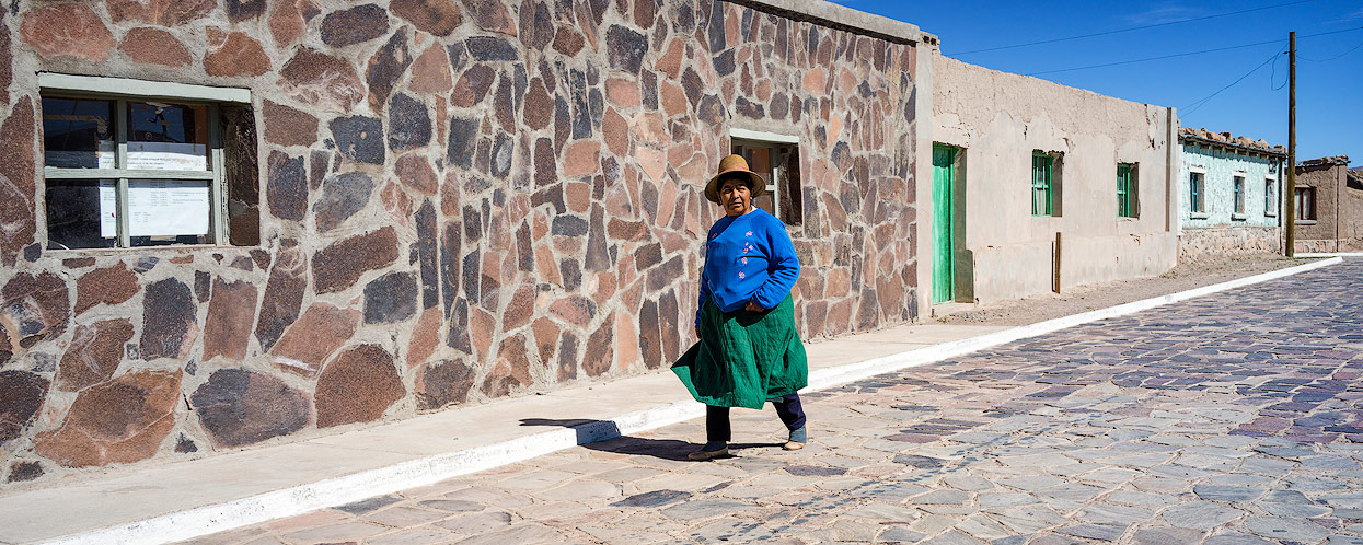
Socaire and Toconao
On the way, you’ll pass the two villages of Socaire and Toconao with their attractive churches, graveyards and centres. A good place for a break!
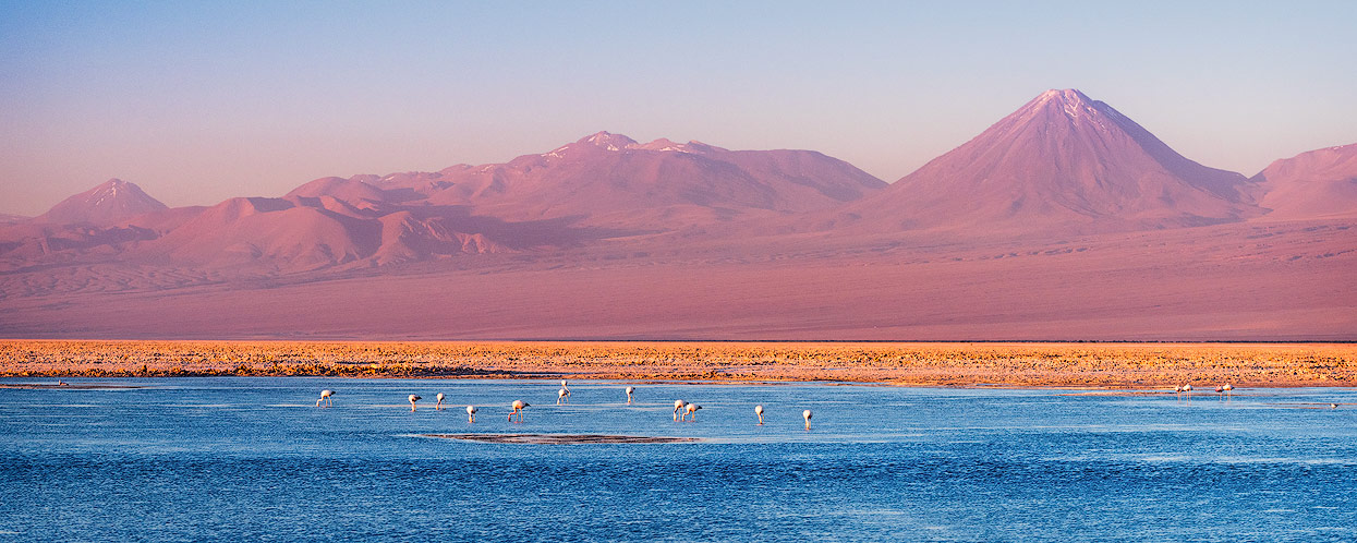
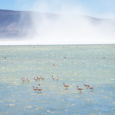
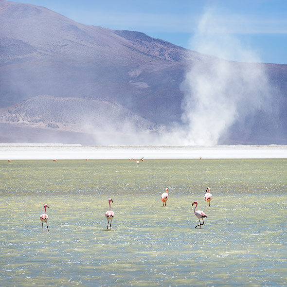
Laguna Chaxa
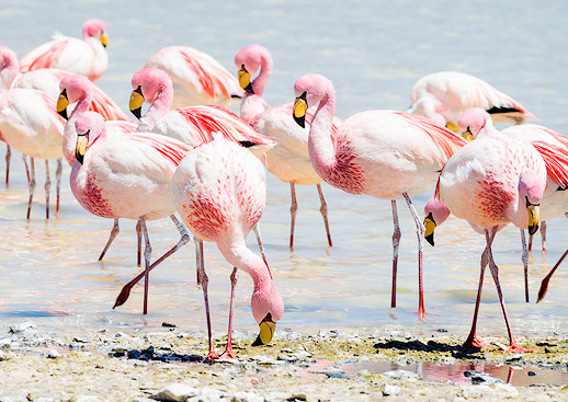
All the tour guides swarm around the Laguna Chaxa and its gorgeous light in the evening, so we arrived exactly at sunset. I don’t know if it was the high expectations or if we caught it on a bad day, but the sunset wasn’t nearly as dramatic as we’d hoped. But watching the flamingos in the evening light is a beautiful memory.
SPACE
Another highlight - this time without photo equipment - awaited in San Pedro after sundown. The Atacama Desert isn’t just known for its landscape, but also its breathtaking starry sky. There are few places in the world with similarly excellent conditions for stargazing, which is why San Pedro has a global reputation among astronomers.
A SPACE bus took us around 20 minutes into the desert: the lower the light pollution, the better the view of the stars. Our Canadian guide brought us close to the universe with his exceptional knowledge and humour. SPACE tours only take place on clear nights and not on the night of the full moon. After this interesting evening, I almost regretted that we didn’t plan in more time for stargazing. There were plenty more highlights in the Atacama Desert, such as visiting ALMA, an international radio telescope observatory with 66 parabolic antennae measuring around 12 metres in diameter.
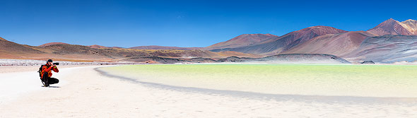
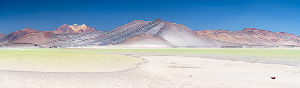
Salar de Tara (Dalí Desert)
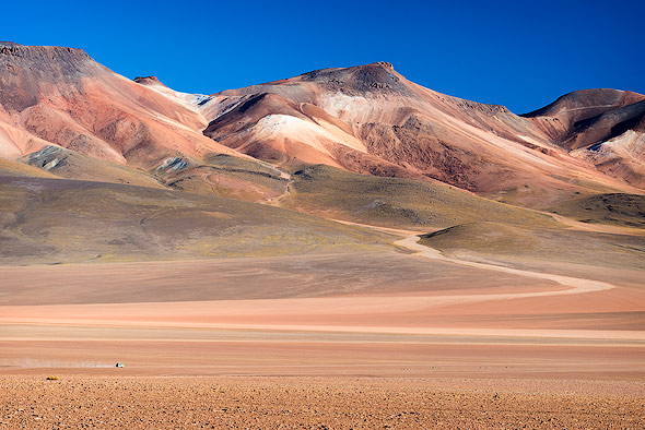
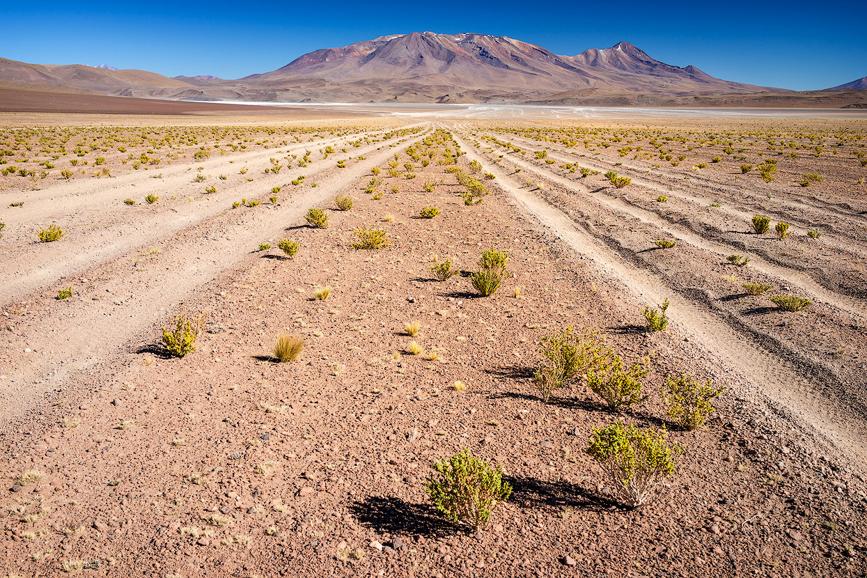
On the second day, we wanted to visit the Salar de Tara, a geomorphological salt flat around 120km to the east of San Pedro de Atacama. Surrounded by impressive landscapes, the route took us straight to the Bolivian-Argentinian border. And the very well maintained roads took us straight up to 4,700 metres above sea level. The air is very thin and even the smallest exertion can take your breath away. The pass seemed popular with bikers, but less so with tour guides - good for us!
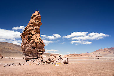

The landscape was simply fantastic, and we stopped for a photo op on almost every curve. Mountains of all sizes alternate with craters, salt lakes and wonderful boulders in shapes that only nature could dream up. The Monjes de la Pacana look like one of Salvador Dalí’s creations, which is why the Salar de Tara is also called the ‘Dalí Desert’. The giant boulders aren’t far from the road, and there are no barriers or entrance fees - just a unique natural wonder that you’re free to admire.
We went on to the Mirador Salar de Loyoques, just 23km from Paso de Jama and the Argentinian border. The gorgeous panorama across the salt flat is great for just letting your mind wander, so we admired the view and watched the flamingos in peace. The only reason we left was the thin air, which we still hadn’t gotten used to.
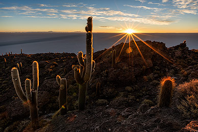
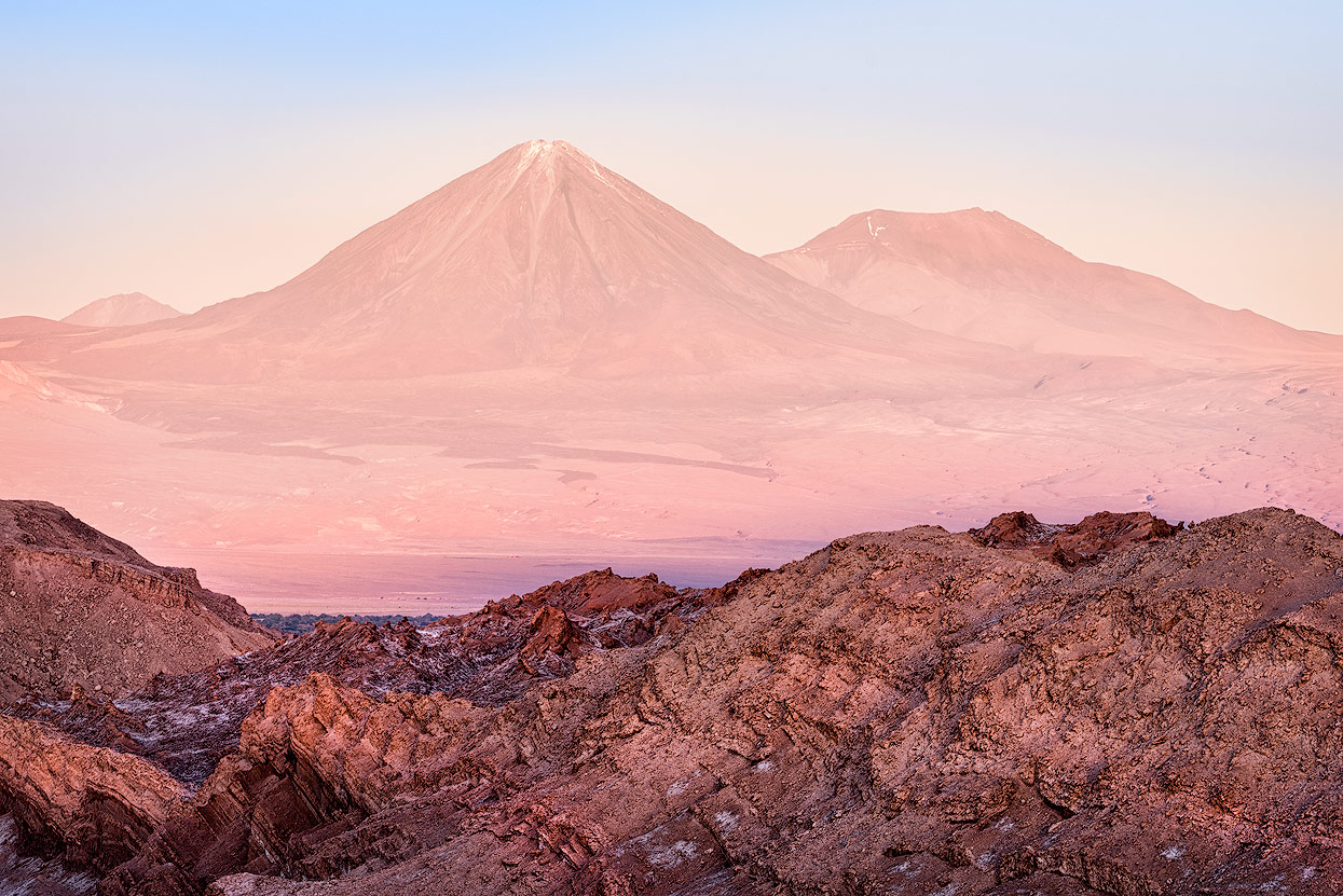
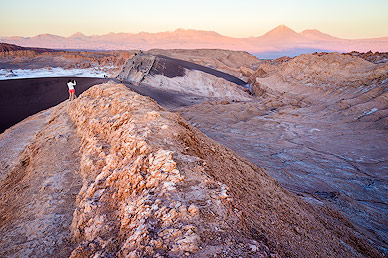
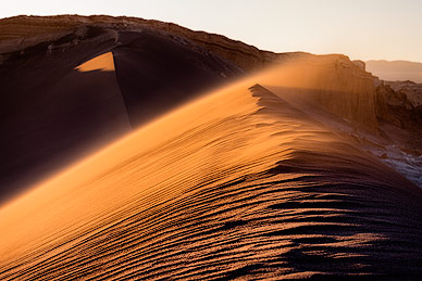
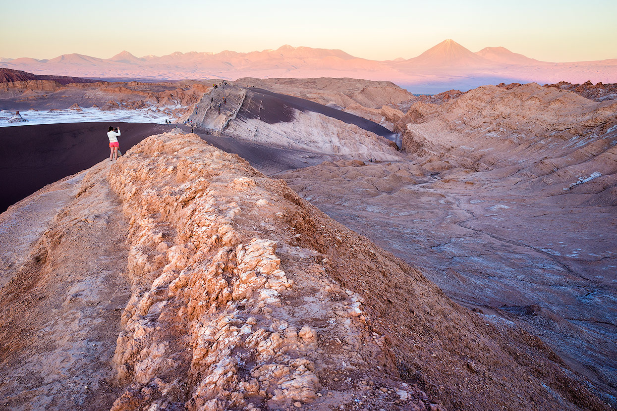
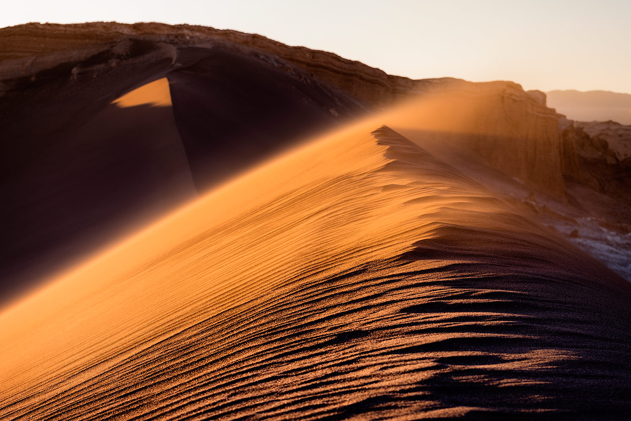
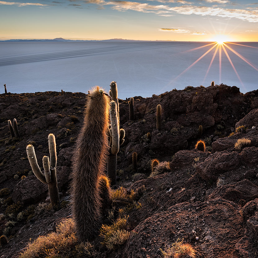
Valle de la Luna (Moon Valley)
In the late afternoon, we headed to the most popular and most visited site in San Pedro de Atacama: Valle de la Luna. If you prefer a faster pace, you can visit Moon Valley on two wheels (bikes can be rented in San Pedro). Bikes have even more benefits, as drivers can’t make spontaneous stops in the valley as it would stop the flow of traffic. The Valle de la Luna seemed to me to be better guarded than a Swiss government building, but it’s so impressive that a visit is still worth it despite the crowds and the strict rules.
The valley is at its most beautiful when the sun hangs on the horizon, casting long shadows - it’s worth climbing a dune with a view with your camera and tripod.
Altiplano in Bolivia and Chile
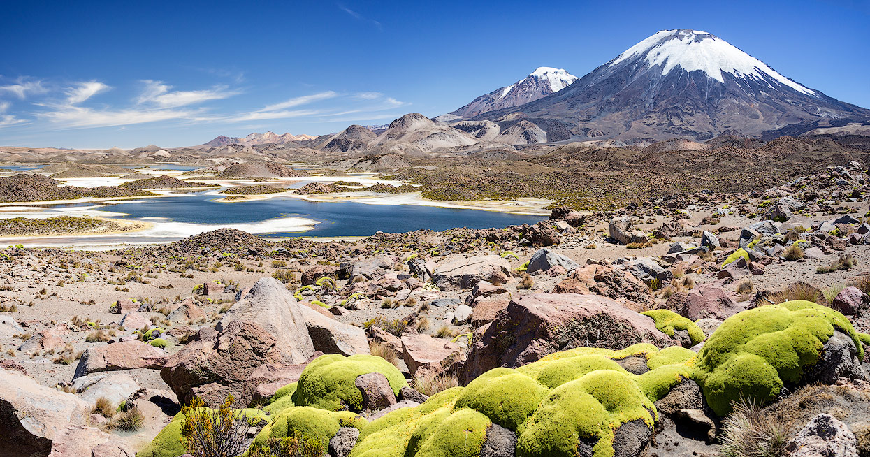
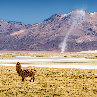
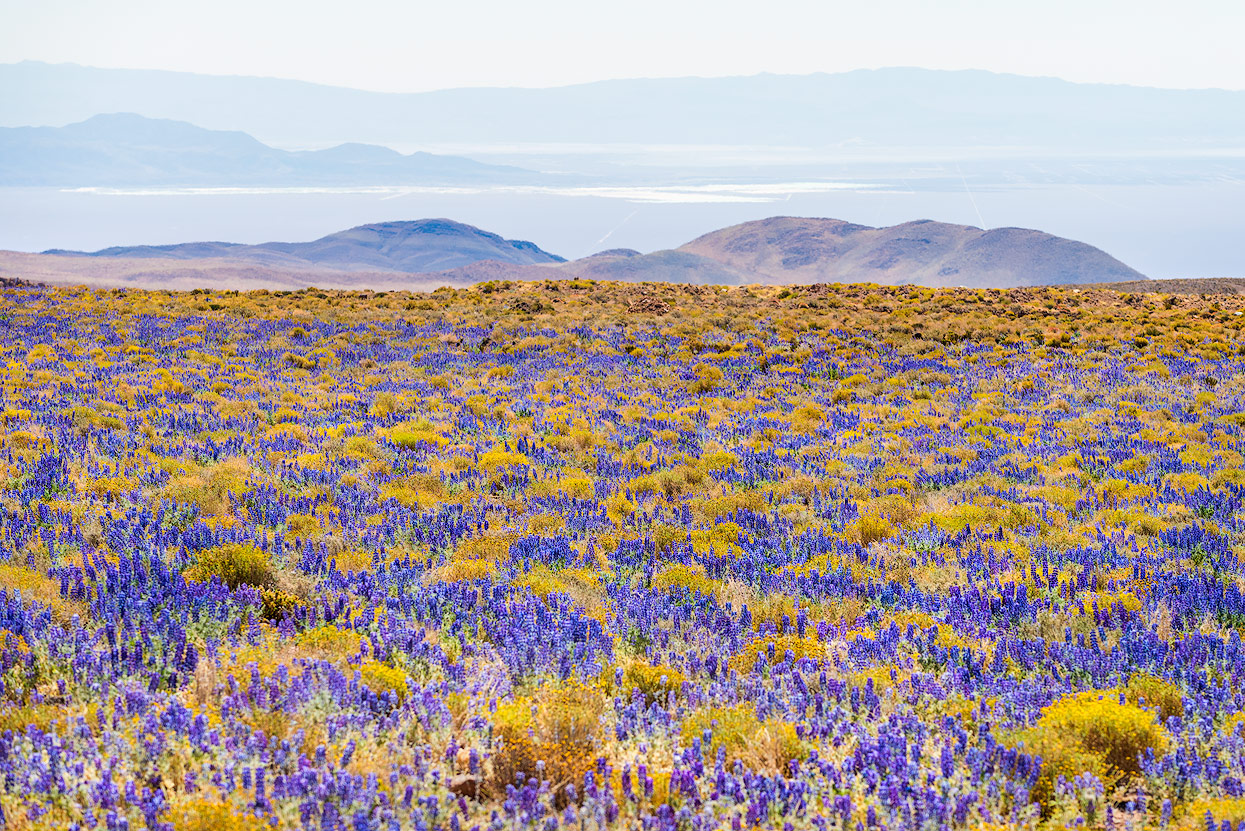
Stretching around 600 miles at its widest point and covering an area of 40,000 square miles, the Altiplano is the largest and highest plateau in the world outside of Tibet. It is also home to Titicaca Lake, the highest navigable lake in the world, and Salar de Uyuni, the largest salt flats in the world. While such a high altitude sounds like the Altiplano might be cold, barren, and desolate, it is actually home to a number of plants, animals, and human settlements.


Itinerary
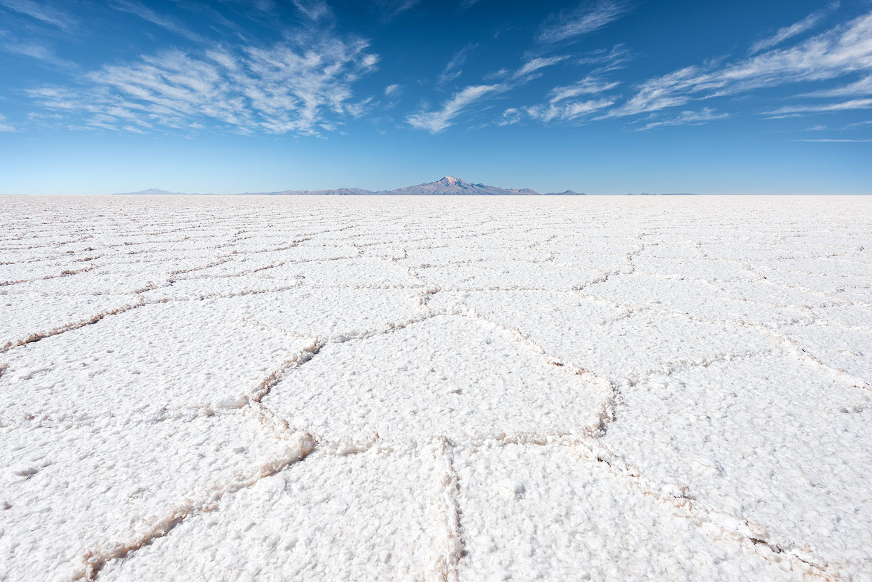
San Pedro de Atacama is a good base for longer trips in the Salar de Uyuni, the largest salt flat im the world. Measuring in at over 10,000 square kilometres, the Salar can even be seen from space.
When we started planning our trip, we thought the journey to Bolivia would be so easy: we’d rent a 4x4 with GPS and spend the nights in our tent at the most beautiful places we could find. As soon as we started researching our trip, we had a rude awakening: no Chilean care hire companies let you travel over the border to Bolivia - at least we didn’t find any near Calama. I know people that have travelled over the border in a Peruvian rental car but they had problems at customs due to incomplete or missing documents. It’s supposedly less complicated with your own car, but our situation didn’t allow for that, so we started to look for a good tour operator. The stories on the blogs are hair-raising and it seems that you just can’t be sure that the company you booked will still exist by the time of your tour.
Choose between cheap group and exclusive private tours
Fundamentally, there are two types of tours: very cheap group tours or relatively expensive private tours with a private driver. It’s not uncommon for providers to offer cheap group tours to travel back from Salar de Uyuni to San Pedro in the same day. When it comes to tours in Bolivia: the cheaper the tour, the worse the service. If you have special needs for your tour - so any landscape photographer - only a private tour will be any good for you. Here are some things I wish our tour operator had done:
- Longer photo stops at Laguna Colorada and Laguna Hedionda in the Bolivian highlands
- Sunrise on Isla Incahuasi (cactus island in the Salar de Uyuni)
- Isla Pia Pia and Isla del Pescado, also in the Salar de Uyuni
- Longer photo stops at the Surire salt lake in the Chilean highlands
- Visiting a few photo points at the Parinacota volcano in Lauca National Park
Last but not least, we didn’t want to return to San Pedro de Atacama from Uyuni, rather head north via Laguna Surire (Chile) and the Lauca National Park to Arica. The northernmost Chilean city is located by the sea, right by the Peruvian-Chilean border, and is the driest city in the world.
We invested a lot of time searching for the right travel agent, and it paid off in the end: Mayuru Tours was able to offer a tour to meet our needs. The six-day trip for 2 people from San Pedro de Atacama via the Bolivian highlands to Arica including all special requests and meals cost a total of $3,620.
Bolivian Highland Lakes
Chilean-Bolivian border
Our tour began in San Pedro de Atacama, from where we were taken to the Chilean-Bolivian border station ‘Hito Cajon’ in a comfortable bus. At 4,500m above sea level, Valerio, our Bolivian guide and driver, was already waiting. You can get the Chilean exit stamp in San Pedro de Atacama by the way. At Bolivian customs, there were lots of tourists queuing and it took a while to get a stamp.
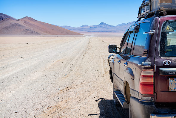
Although we didn’t pay the extra $400 for an English-speaking driver, Valerio had a pretty good handle on the language. Valerio owns ‘El Desierto Tours’, based in Uyuni, and has been working with Mayuru Tours for a number of years. It’s important to know that Chilean and Bolivian tour operators aren’t allowed to cross the border, so every border crossing comes with a new vehicle and driver. Speaking of the vehicle: you only see old Toyota Landcruisers in Bolivia, which Valerio said is the best car for the terrain. Whenever you see a Land Rover or off-road camper, the chances are that you’ll also see a licence plate from Germany, France or Switzerland. We greeted the adventurers from our home country with a slight amount of jealousy.
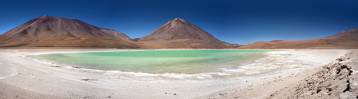
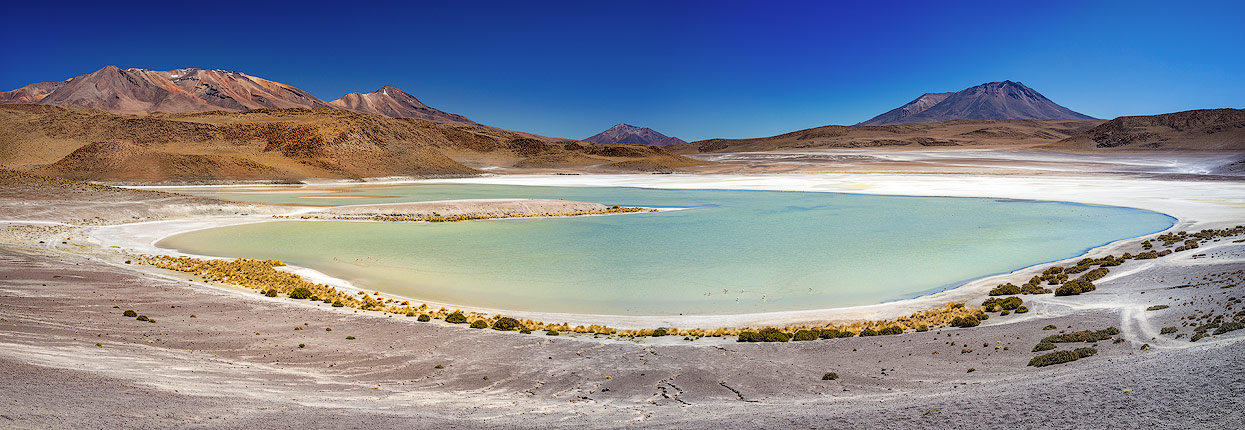
Laguna Blanca & Laguna Verde
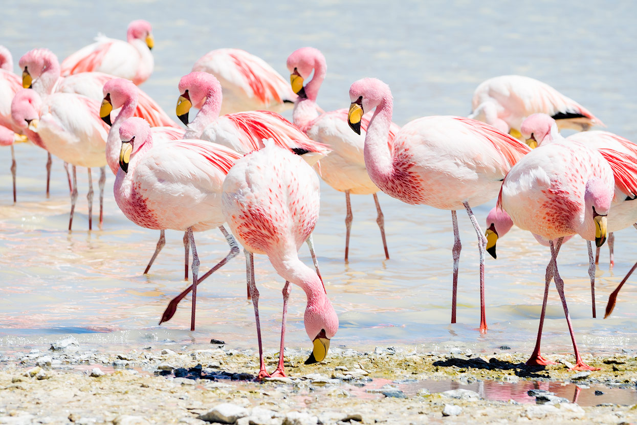
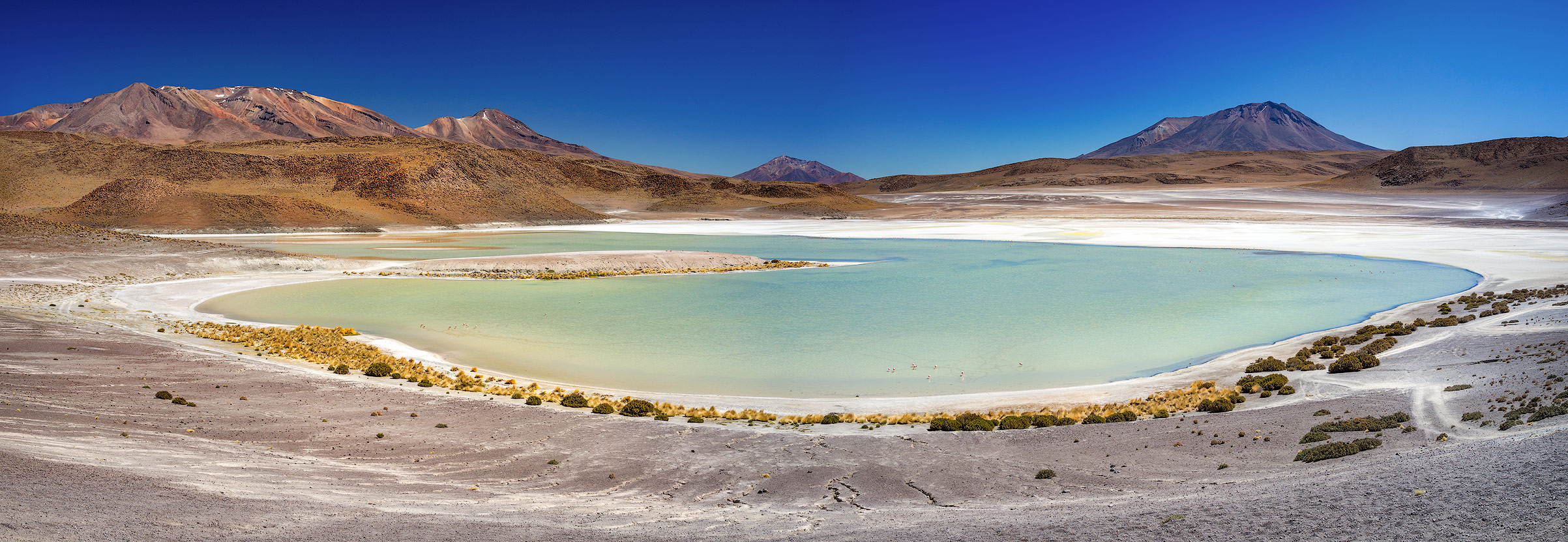
A couple of minutes’ drive from the border, we entered the ‘Fauna Andina Eduardo Abaroa’ National Park, Bolivia’s most popular national park with over 60,000 visitors a year. You can see the ‘Bianca’ and Verde’ lakes from the park entrance. Opposite, the inactive volcano Licancabur dominates the Atacama Desert with its 5,920 metre peak. You get quite close at the Laguna Verde - the perfect backdrop for a panoramic photo! Due to the high mineral content, the Laguna Verde isn’t home to any flamingos, who generally prefer the larger nearby Laguna Blanca.

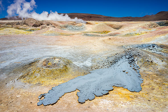
Sol de Manaña Geysers
After a few kilometres, we reached the ‘Sol de Mañana’ geysers. Unlike in Yellowstone National Park, the hot springs and steaming fumaroles are freely accessible. There are hardly any barriers or path markings in Bolivia - commendable, actually! This let us enjoy this hotspot even more. The fumaroles aren’t covered by cheaper tour operators (presumably to save time), so we had the whole place to ourselves.
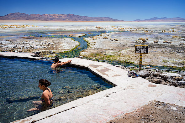
A Bath at 4,000 Metres
Much more popular are the ‘Termas de Polques’ hot springs at the ‘Salar de Chalviri’. What more could you want than a 38°C bath at 4,000 metres with a wonderful panoramic view?!
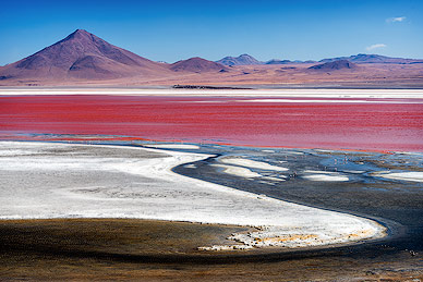
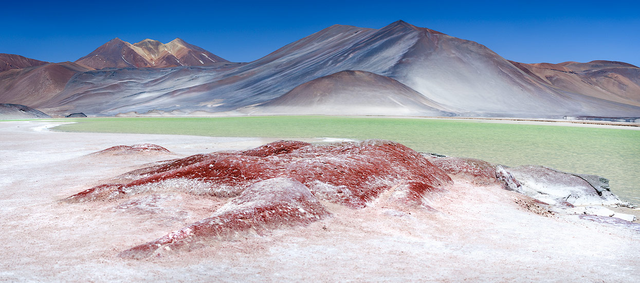
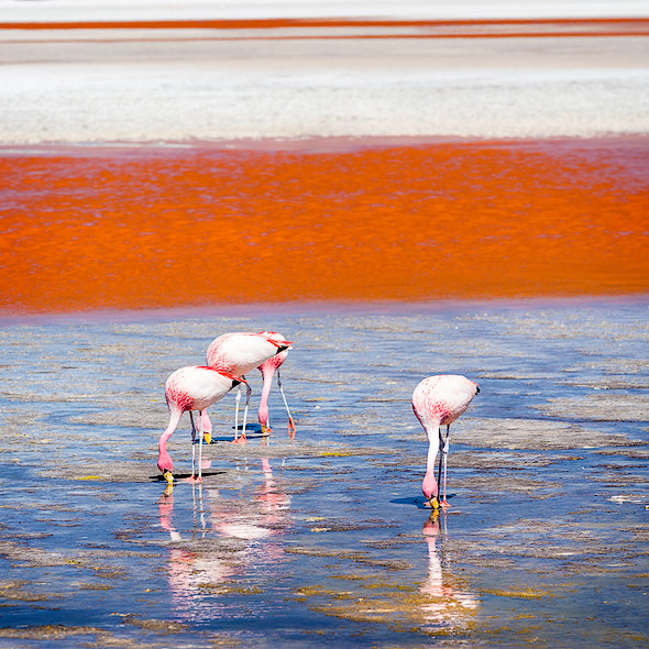
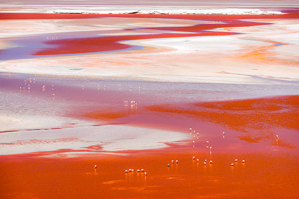
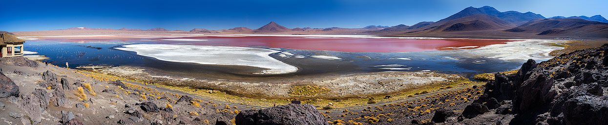
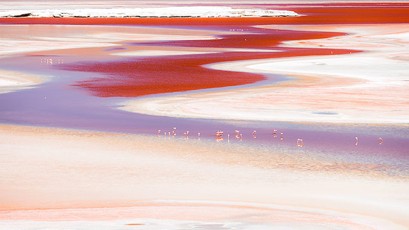
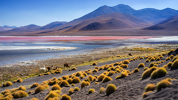
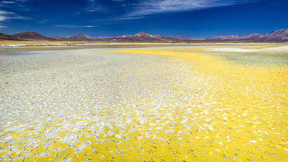
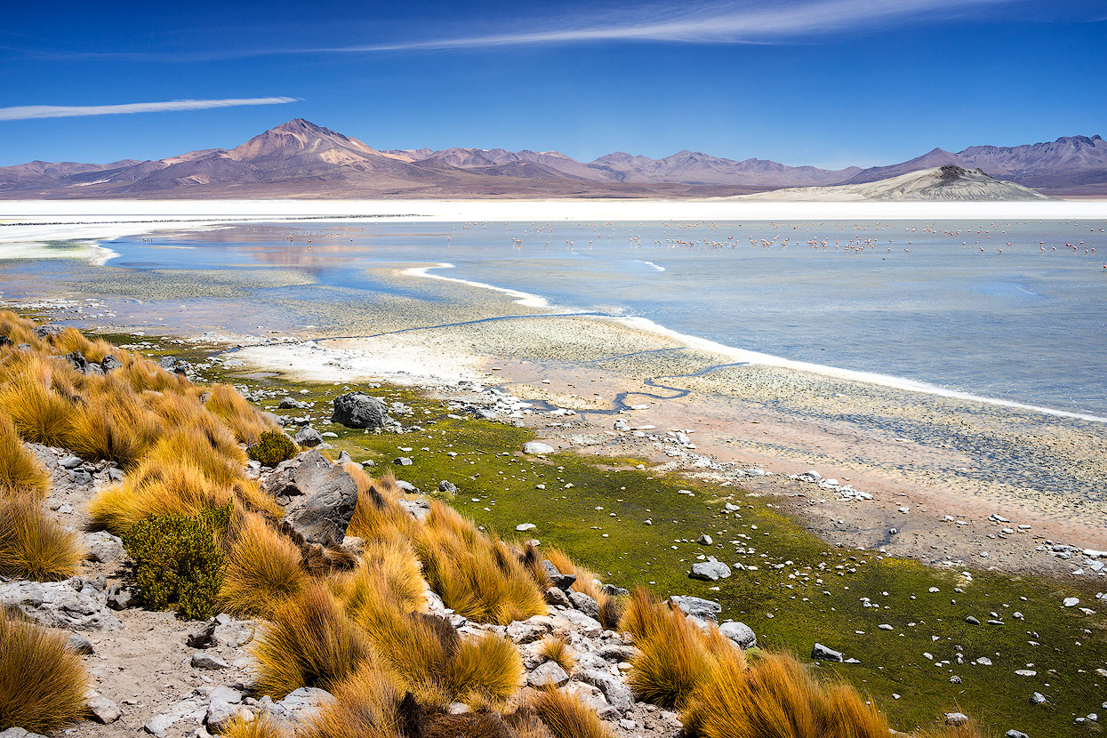
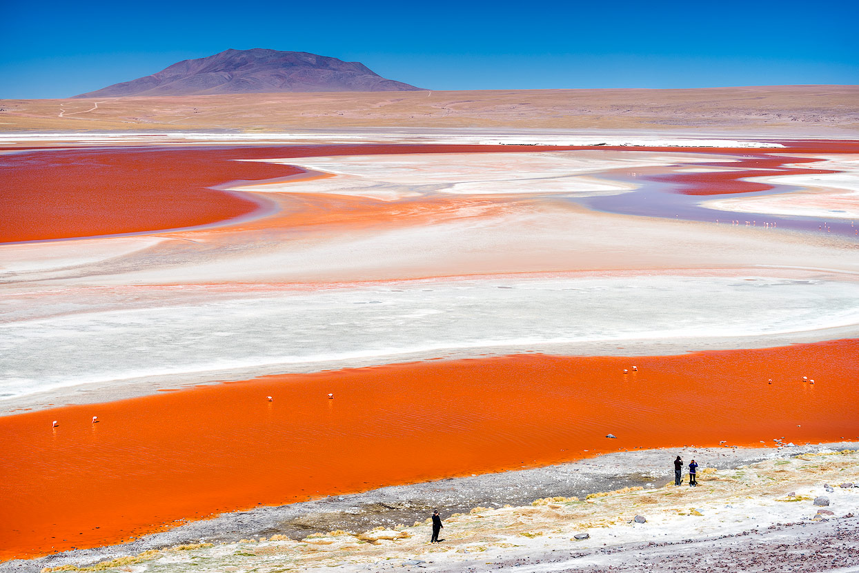
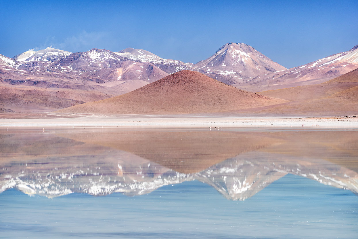
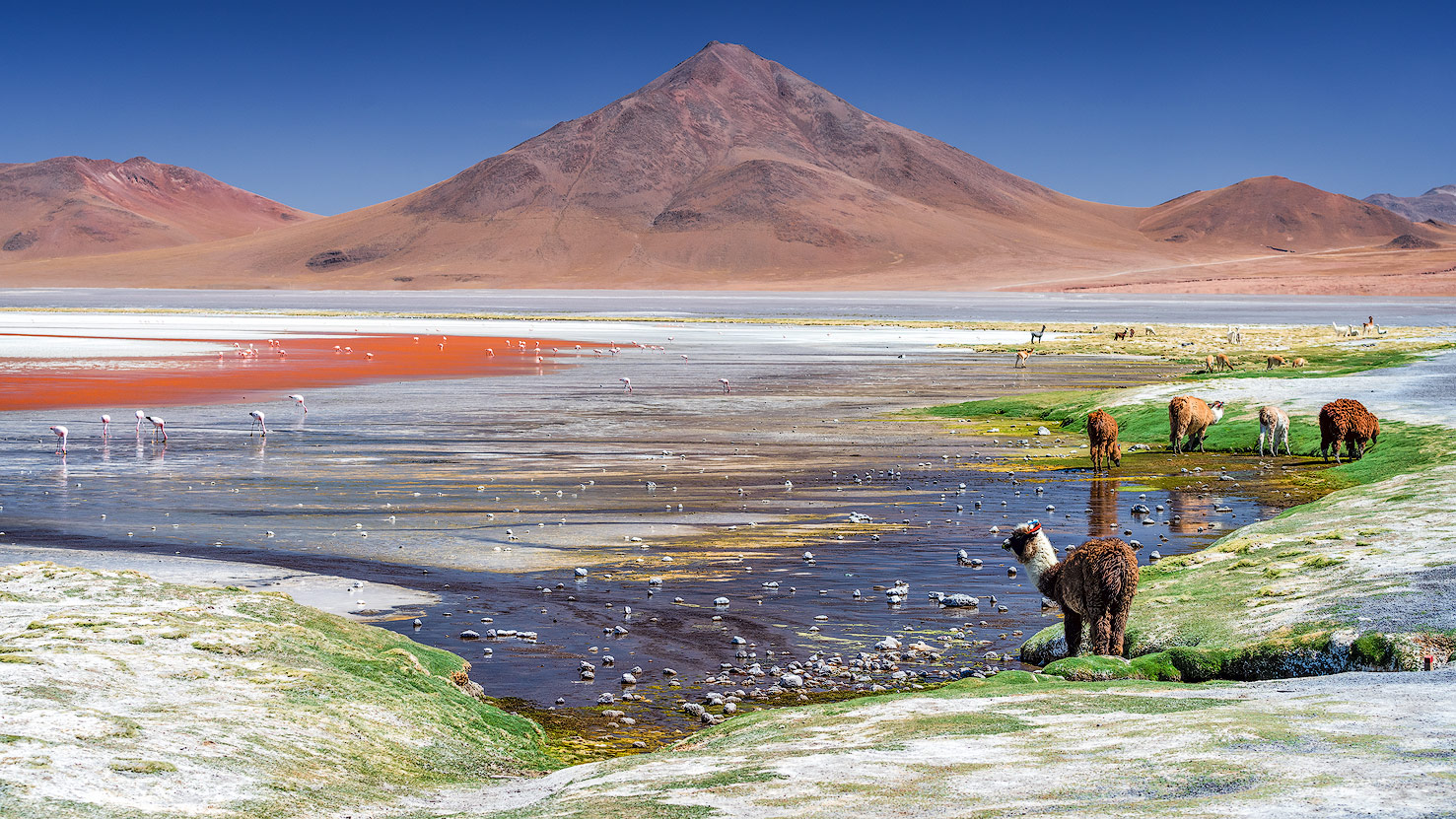
Laguna Colorada
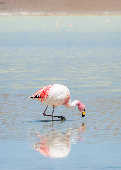
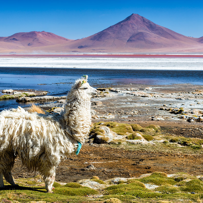
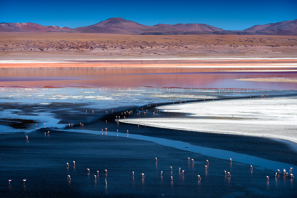
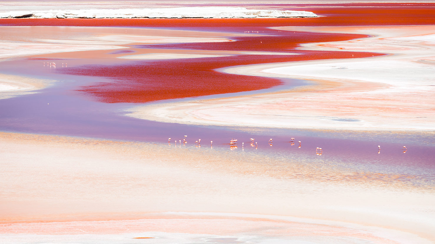
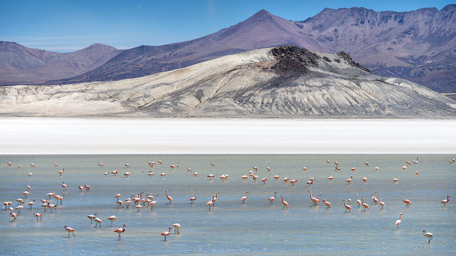
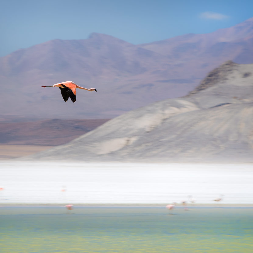
By the afternoon, we’d reached the unique Laguna Colorada, a highlight of the trip. After a white lake and a green lake, we got to see a red one! You can only see this in the highlands of South Bolivia: the red colour is caused by the high mineral content (including borax) and the special algae that the flamingos love - there are three different species here (Chilean, Andean and James’s flamingos). From the official look-out point (a small hill), you can drink in a 270° panorama of the 60km2 lake, which (quite rightly!) was nominated as the eighth wonder of the world.
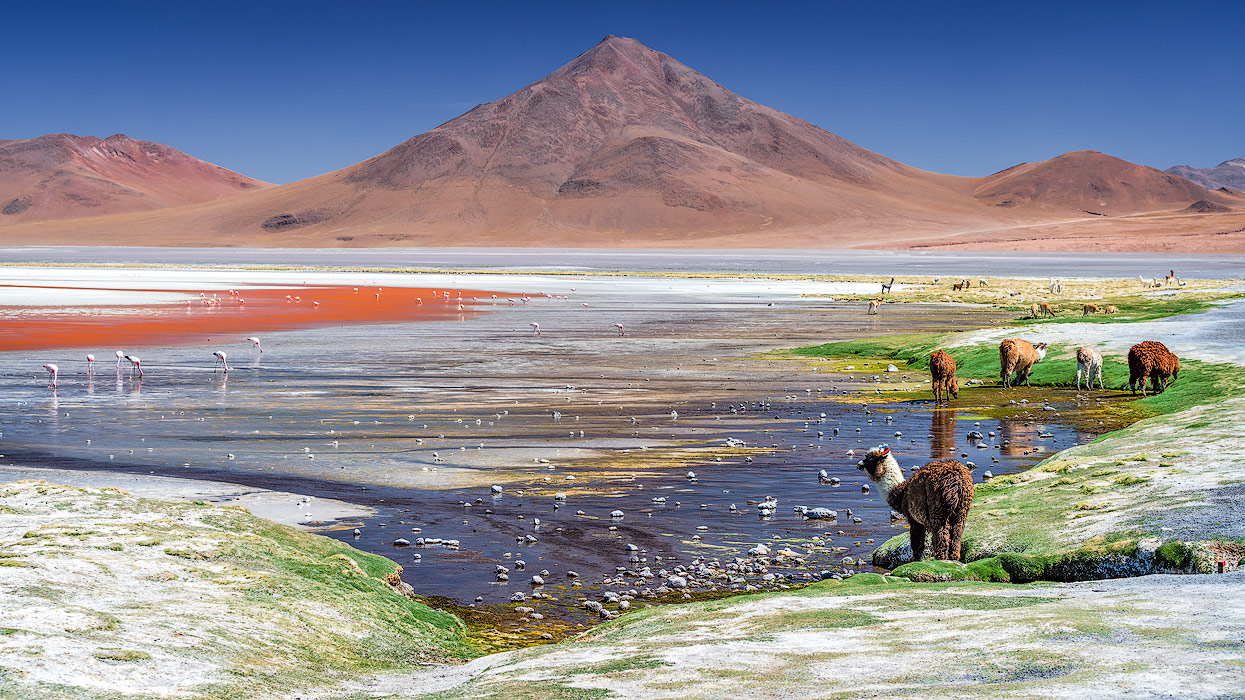


Apart from the official look-out point, it’s also worth stopping for a photo from the other side of the lake.
Hotel Tayka del Desierto
We ended the day in the wonderful Hotel Tayka del Desierto, where you can experience luxury at 4,700m above sea level. At least our acclimatisation in the Atacama Desert was worth it: we enjoyed a fantastic meal without headaches or any other symptoms.
In the night, the temperature dropped below zero and I was happy that I was able to squeeze in another set of shots of the wonderfully clear starry sky from under my three(!) blankets.
Los Lipez Desert
It was only the next morning that we realised that Bolivia and Chile aren’t in the same time zone. The fact that the clocks are an hour behind in Bolivia (although it’s east of Chile) was definitely a surprise to us! Thankfully, Valerio is a spontaneous type and so we started our day an hour early. On the itinerary for today were more lakes, known for their large populations of flamingos.
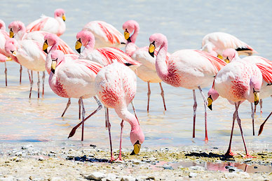
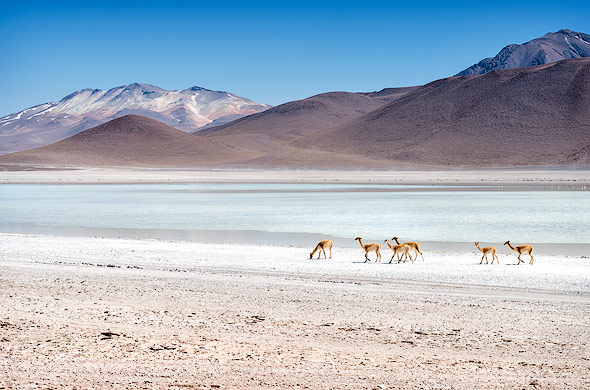
Honda, Charkota, Hedionda & Cañapa Lakes
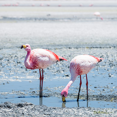
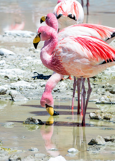
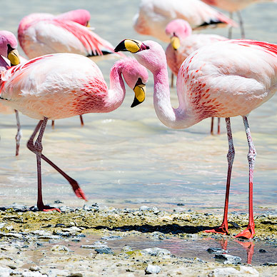
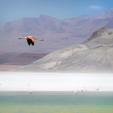
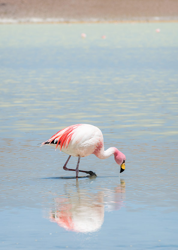
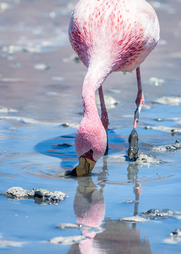
These four lakes are definitely worth seeing, but the Laguna Hedionda was especially impressive. The many flamingos are obviously used to people, as they come right up to you and proudly strut through the lake as if they’re walking on a mirror. While you’d need a 500mm lens for a close-up of a flamingo at the other lakes, a 50mm lens is plenty here.
Watching these wonderful birds eat is a joy, and it’s hard to stop staring. As with the Laguna Colorada, it’s best to plan in at least 2-3 hours for this stop.

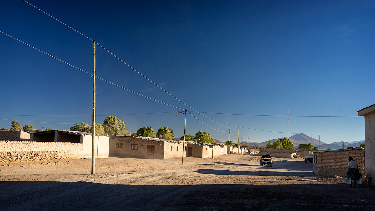
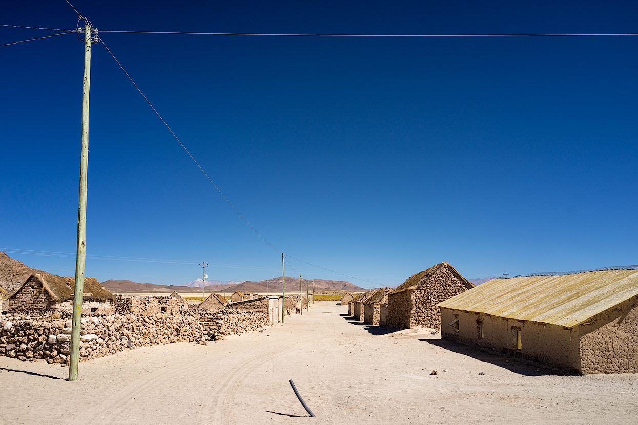
San Juan
We reached today’s destination, ‘San Juan’, a small village near the Salar de Uyuni, in the evening. We passed countless quinoa fields on the way. Bolivia is the source of around 70% of this product worldwide, but our guide told us that this export hadn’t increased local prices, so the Bolivians can continue to enjoy their favourite side dish at reasonable prices.
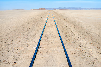
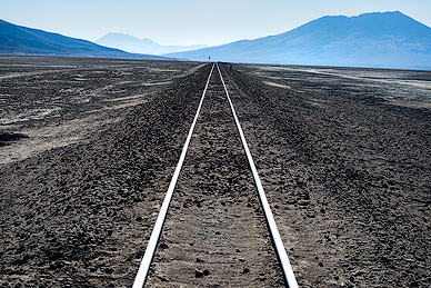
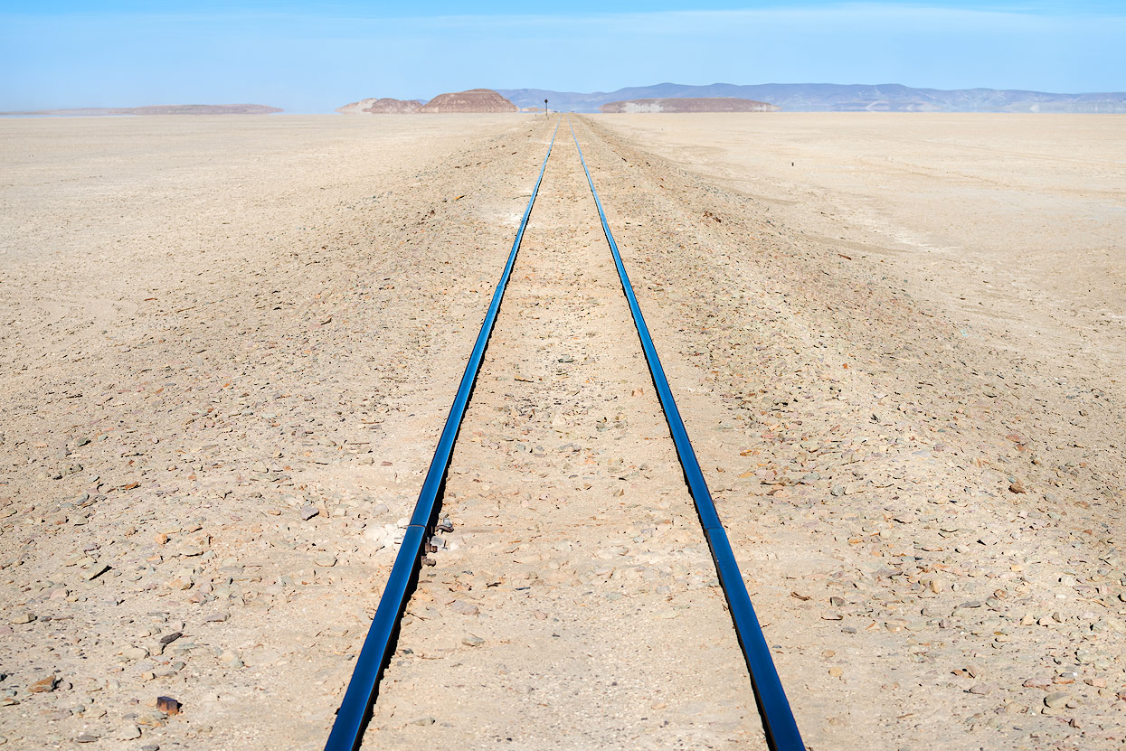
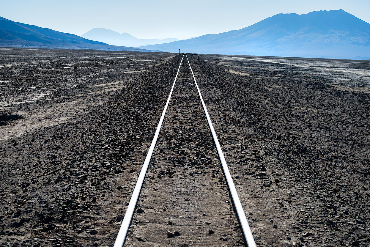
Before San Juan, we unexpectedly crossed railway tracks, although Valerio said that the narrow-gauge train doesn’t travel that often. On our walk through San Juan, we saw a couple of goats - it seemed like only a few tourists come by here and the village seemed like a ghost town. As we mentioned this to our guide, he said that San Juan is the centre of the area and is considered well connected and downright lively…

Salar de Uyuni
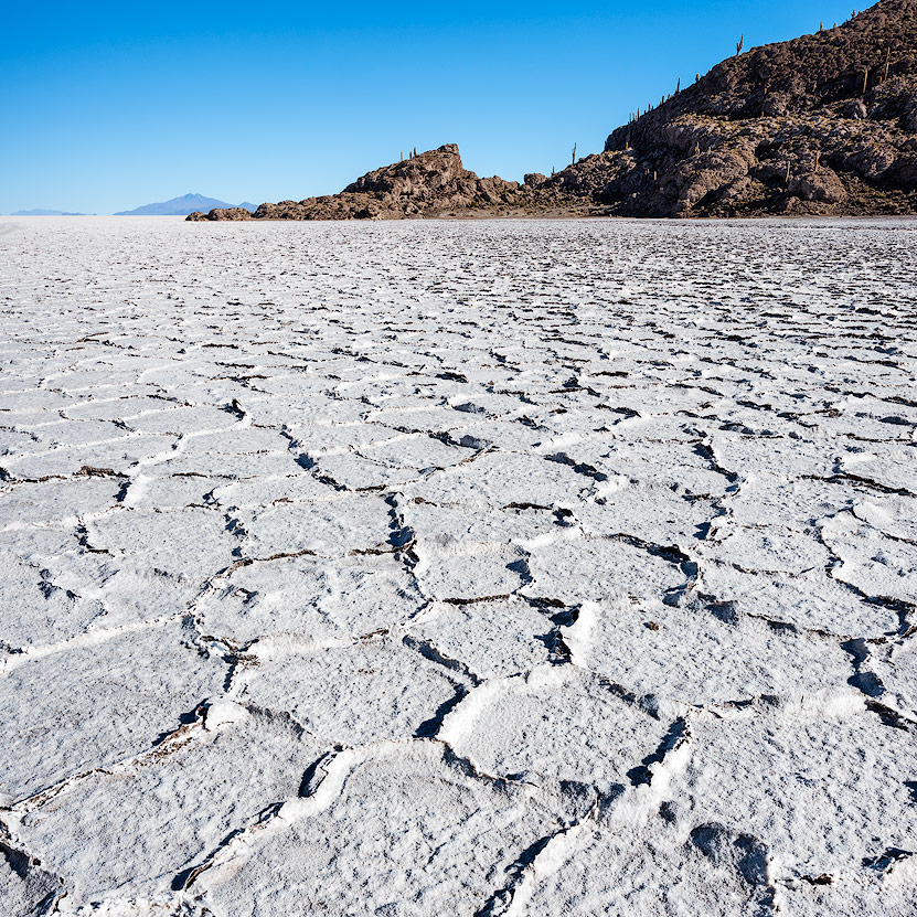
The next morning, we took narrow tracks to the next highlight of the trip: Salar de Uyuni, also known as the biggest salt flat in the world! The Salar is one of the most popular visitor attractions in all of South America. If you want to visit in the rainy season, you might not be able to find a driver for a trip into the salt flat - driving over the standing water isn’t just dangerous (because of huge holes in the ground), but also damages vehicles. In March, when the water level is only a couple of centimetres high, you can take fantastic photographs playing with the reflections. If you plan your trip at the time of a full moon, you can look forward to a sky full of stars and a fantastic view of the Milky Way.

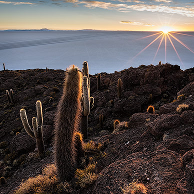
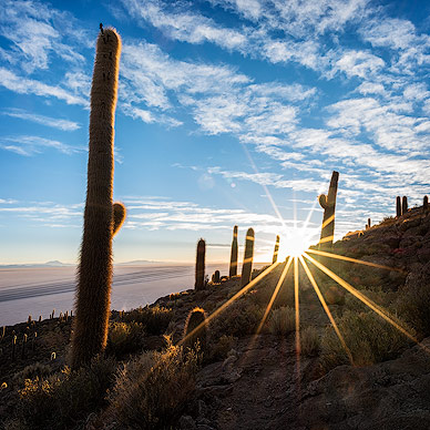
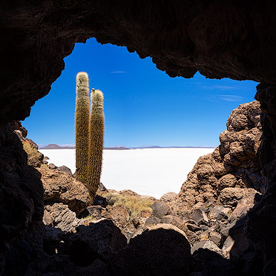
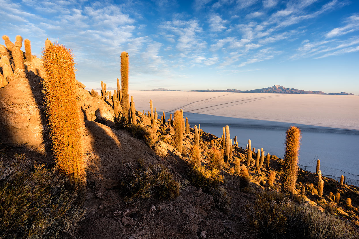
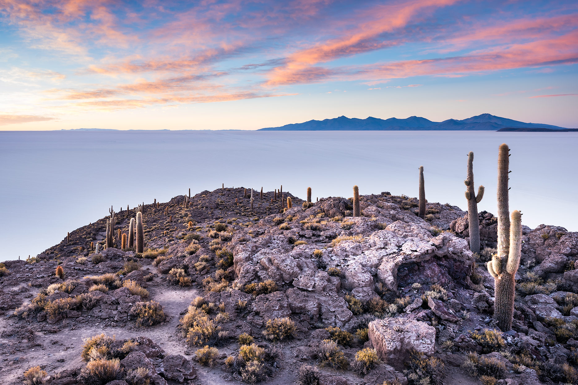
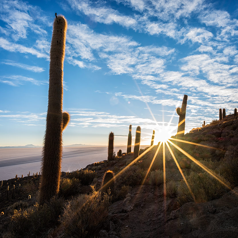
If you look for photos of the Salar de Uyuni, you’ll mostly find creative perspective photos. The cactus islands in the middle of the Salar are also popular. The best-known and most popular is the Isla Incahuasi: here, you’ll find hundreds of cacti and a footpath around the island. You have to pay to enter but it’s still definitely worth a visit!
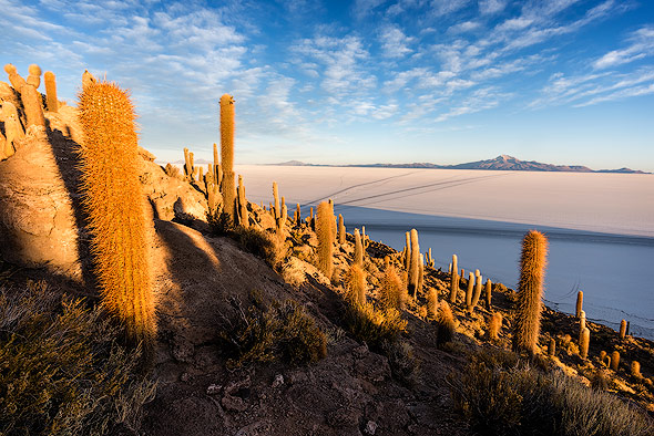

Many tourists don’t know that there are more islands with beautiful cacti apart from the Isla Incahuasi - the best alternatives are the Isla del Pescado and the Isla Pia Pia. There might be fewer cacti than on Icahuasi, but there are hardly any tourists. Most tour operators only travel to one island, and it’s usually Incahuasi. If you’re travelling solo or with a tent, I’d recommend spending the night on the Isla del Pescado. But you should bring a very warm sleeping bag, as nights on a salt flat at 3,650m above sea level can get very cold!

Our special travel programme meant we could visit all three islands, and then we travelled back to the Isla Incahuasi the next day.
Chilean Altiplano
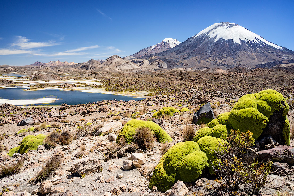
Spanning an area of 1,379 square kilometers in the Andean region of Chile’s far north, the Lauca National Park encompasses altiplano and mountain habitats within its range. A large number of volcanoes are hosted by this park which, together with the neighboring Salar de Surire Natural Monument and the Las Vicuñas National Reserve Salar de Surire Natural Monument, comprise the Lauca Biosphere Reserve.
Back to Chile over the Border Crossing at Colchane
After two nights in and around the Salar de Uyuni, we travelled north-west to the Chilean border. We had to change vehicle and guide again, which worked very well this time. The Bolivian dirt roads stopped here, so our Chilean guide had a luxurious van instead of a Toyota Landcruiser. The village of Colchane is located right at the border, so we had a tour of the area in the afternoon and spent the night there.

Salar de Surire
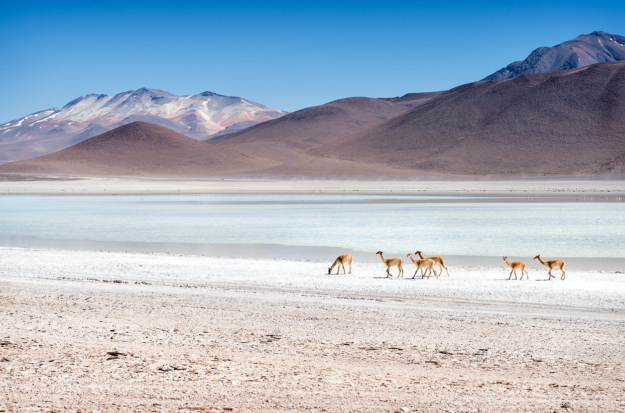
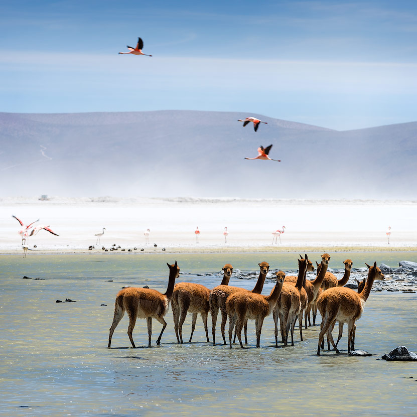
The next morning, we travelled along the active volcano Isluga to the Las Vicuñas National Reserve. At the Polloquere hot springs, we warmed ourselves up and enjoyed the unique landscape: the thermal springs lie directly on the edge of the Salar de Surire (4,245m above sea level), a wonderful and colourful salt flat with countless flamingos, vicuñas and llamas.

There’s a footpath along the Salar, and it’s worth leaving the car to get as close as possible to the shy flamingos. There aren’t any hotels at the Salar de Surire, rather small huts: these are a good way for solo travellers to spend the night in this impressive place.

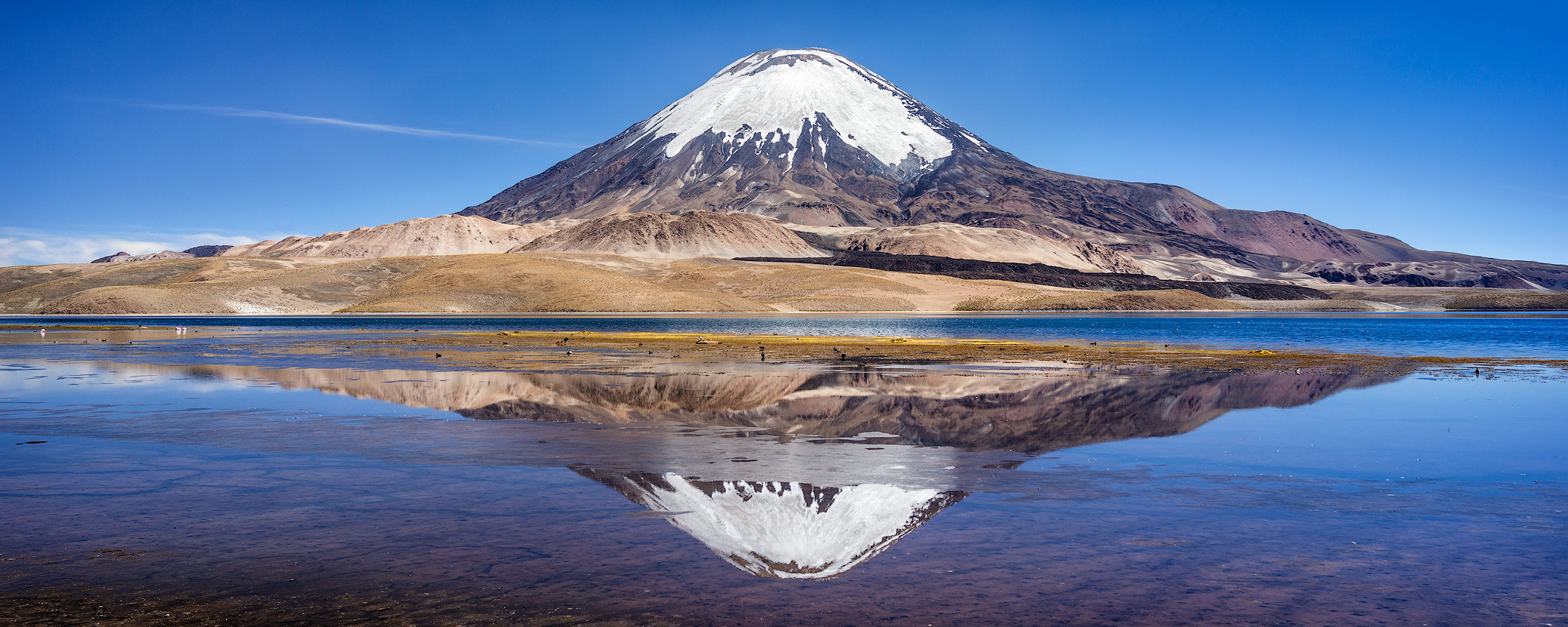
Parinacota Volcano in the Parque Nacional Lauca
At 6,348m high, the volcano in Lauca National Park is located directly at the busy pass that connects Bolivia and Chile. Hundreds of Bolivian lorries cross the border here every day. An impressive show, especially when you think that the majority of all imported wares use this route to get to Bolivia. In the Pacific War over 100 years ago, Bolivia lost its direct link to the sea to Chile. Since then, it has had to satisfy itself with a right to trade from the Chilean harbour and transport wares by lorry from Arica to Bolivia via a 4,000m high pass.

You could spend several days in the Lauca National Park and Parinacota is one of the most beautiful volcanos I’ve ever seen. Its classic coned shape and its snow-covered cap make it one of the best photo motifs in the Chilean highlands. Putre is a great base for tours, as it’s not too high up and has good infrastructure. That’s where we spent our last night before ending our wonderful and impressive journey in Arica. If you want to undertake the same journey in reverse, you should plan at least two days in Putre to acclimatise.
Photography in Focus
For most of my landscape shots, I used a focal length of between 14mm and 50mm.
I could have done with a longer length at a few of the lakes. I had a 70-200mm lens with me, but it wasn’t enough for animal photography (e.g. flamingos). One exception was the Laguna Hedionda, where you could get within a few metres of the birds. Stefan Forster has taken fantastic drone shots of the Salar de Surire and got really close to the flamingos - these animals might avoid people, but don’t seem too bothered about other flying objects. If you have similar plans, you should definitely check what the current regulations are for drones and permits in Bolivia before you travel.
When taking portraits, you should ask for permission first - basic Spanish is very helpful on a trip like this.
The Altiplano is excellent for panoramic photos. I didn’t have any special panoramic gear with me, just used the panoramic features in Lightroom and Photoshop. If you do have suitable equipment, definitely take it with you.
A stable tripod, remote, cleaning materials and a selection of ND and circ pol filters should be a matter of course for landscape photography. Apps like TPE (The Photographer’s Ephemeris), PhotoPills and Google Earth are great for planning photo sites.